Everyone, and I mean everyone, we’d spoken to had said that the road to “The Tip” was shite. Really corrugated with large patches of bulldust etc…
Well, we struck it lucky. Recently graded, there was probably a combined 40kms of the total 585kms that was a ‘bit bumpy’, with us able to maintain a nice, and safe, 80 to 90km/hr on the bulk of the trip up. Something else we didn’t expect is there are long and frequent patches of bitumen right along the track, these are a welcome relief from the dust and provide ample opportunity for safe overtaking.
Due to the expected poor road conditions, we’d planned to do a short, 330km, stint from Cape Tribulation, over the Bloomfield Track then up to Musgrave Station, however, due to the better than expected conditions, we easily made it an extra 100kms to a WikiCamps riverside freecamp just north of Coen.
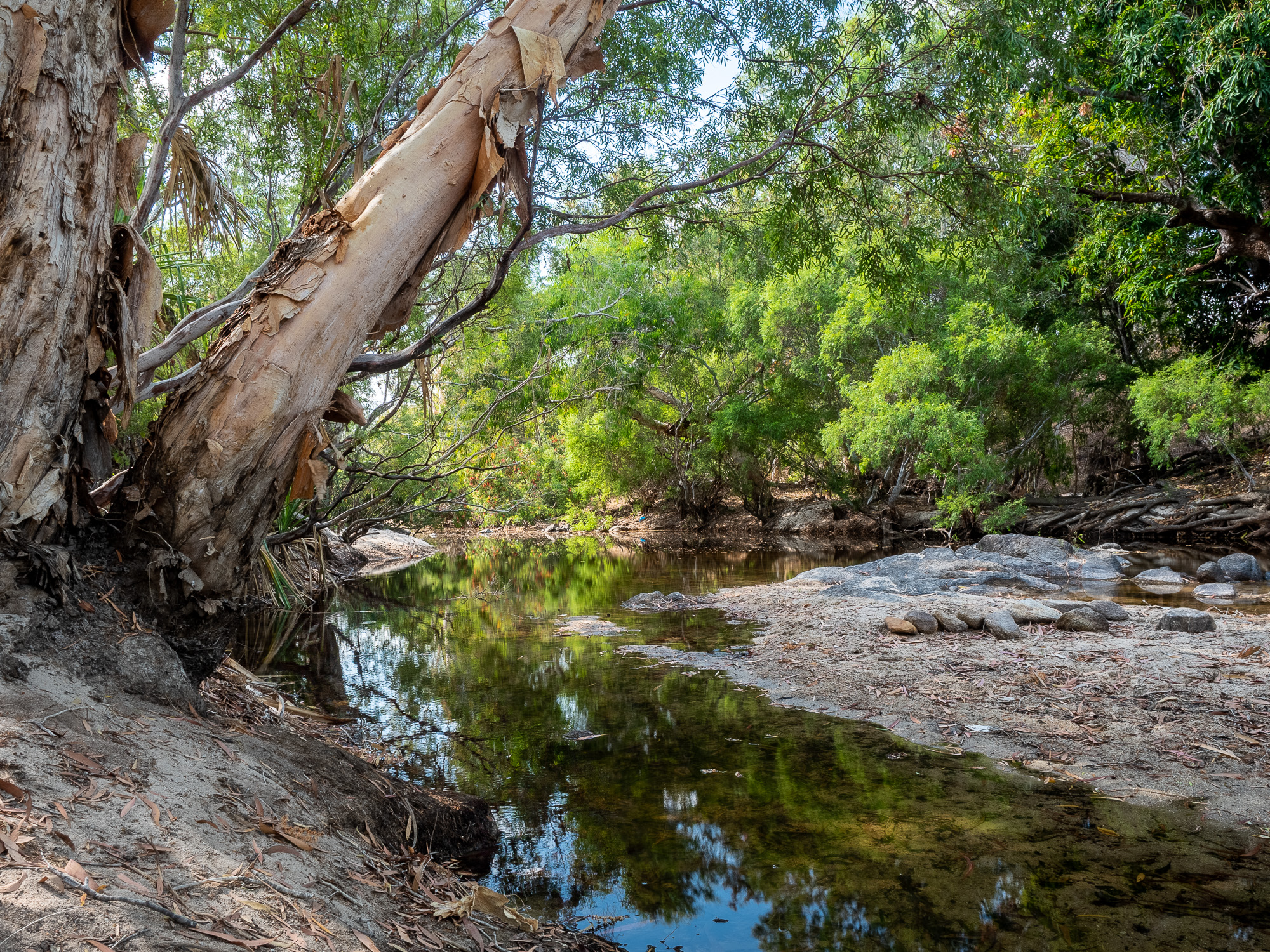
<< Photo credit: Tony – Our riverside freecamp on the Coen River >>
From Coen, it was only 240kms to Bramwell Station, our stop for the next couple of nights. We didn’t expect much of the Station Stay itself, but it was nice enough, with plenty of space and a bar with live music at night. But, Bramwell was the base from which we were able to easily explore the Old Telegraph Track (OTT) and the beautiful Fruitbat, Elliot and Twin waterfalls.
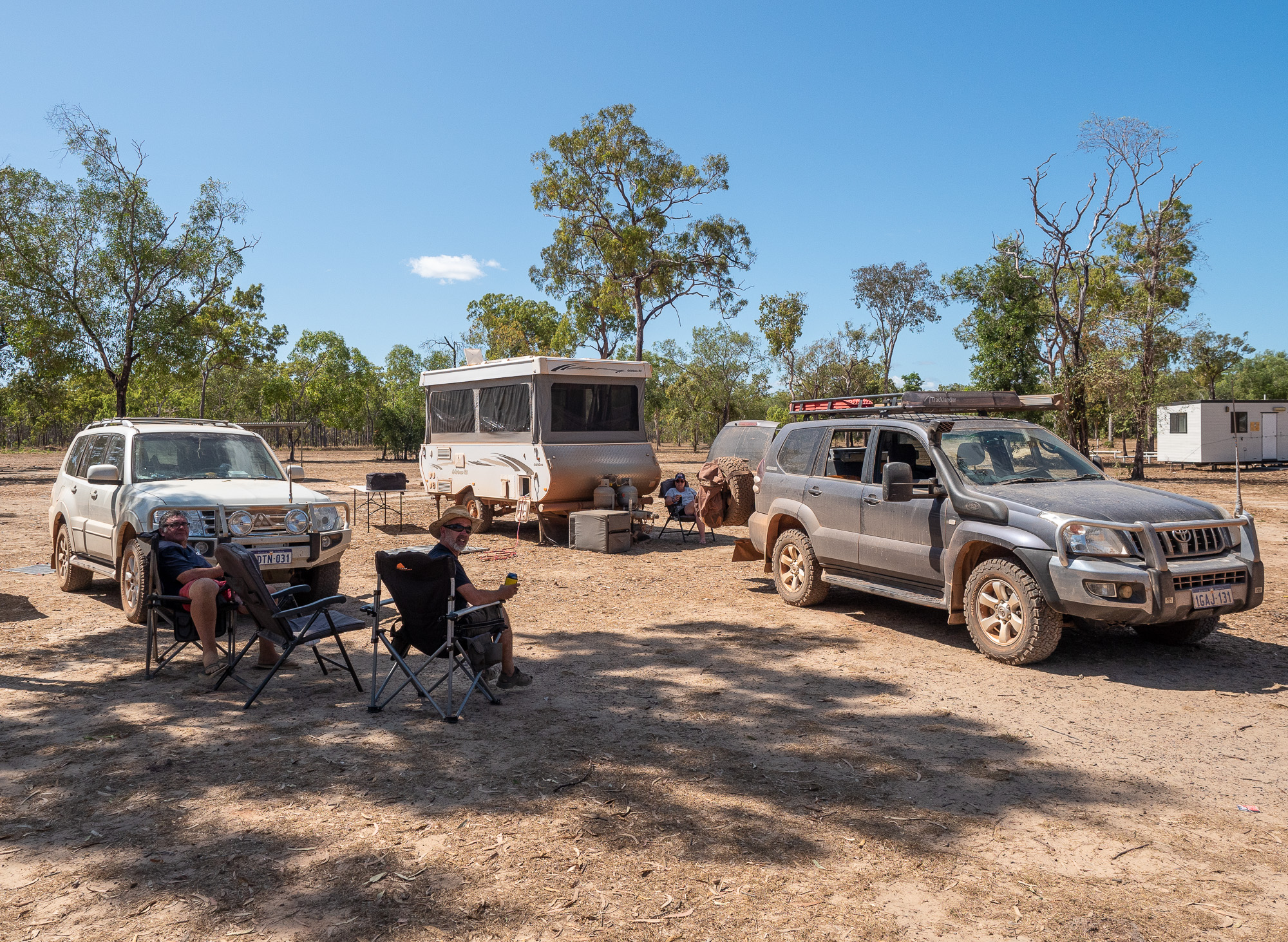
<< Photo credit: Tony – Our campsite at Bramwell Station >>
First up the OTT… After arriving early and being setup at Bramewell before midday, we decided to check out the OTT. Notorious for its creek crossings, we headed north to the Bramwell Junction Roadhouse, and then up the OTT to the 1st crossing at Palm Creek. After taking a good look and some pics, we quickly determined that whilst we reckon we ‘could have’ made it through, both Rod and I decided that we rather not risk the car in the attempt, so it stayed at photos only.
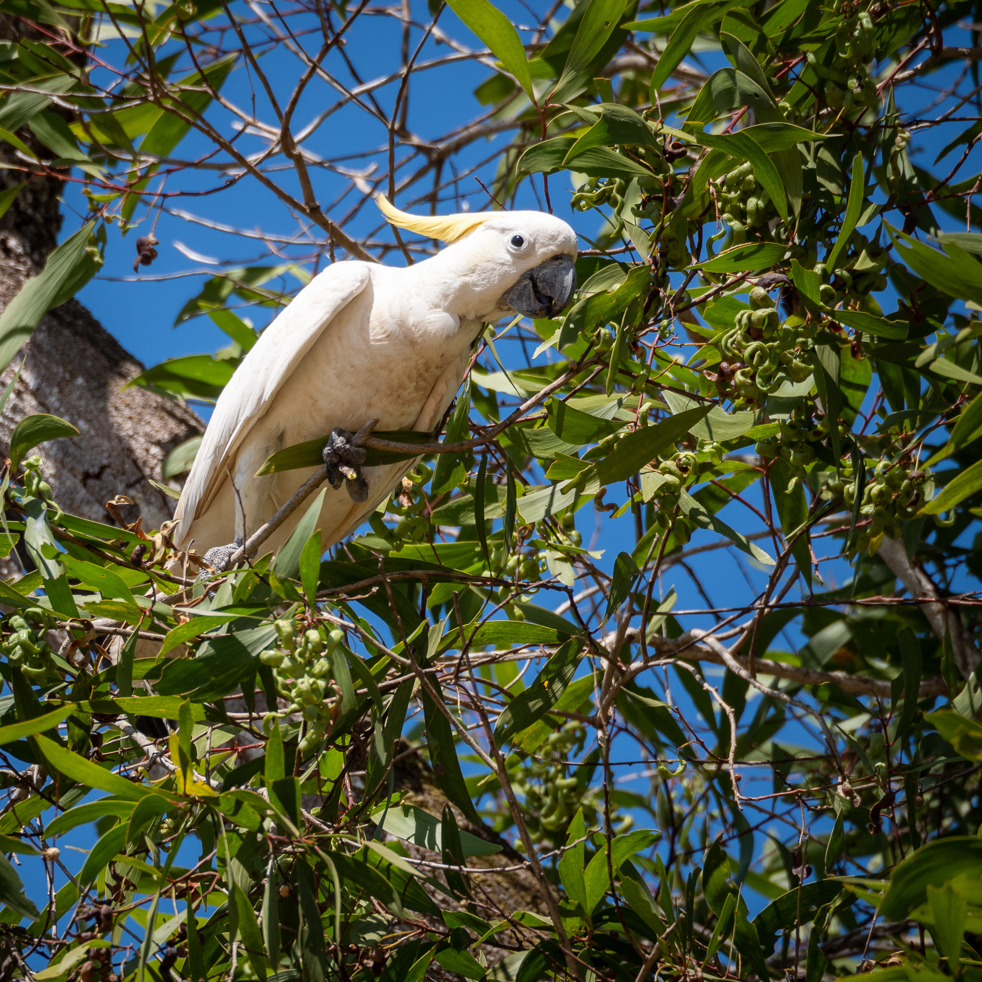
<< Photo credit: Tony – One of the noisy Sulfur Crested Cockatoos at Bramwell Station >>
<< Photo credit: Tony – Gary, our Prado, posing at the top of the Palm Creek crossing >>
Sunday 9th Sept and we headed north again, up the Peninsula Development Road (PDR), to the track out to the Heathcote Ranger Station, which then has a short track into the OTT, just north of the famous Gunshot Creek crossing. Strangely enough, the Gunshot Creek is beautiful, tree lined crystal-clear water, sandy bottom, small fishes etc. But, the hardcore Gunshot crossings are not for the faint of heart. A vertical drop of near 4mtrs, into a puddle of mud and assuming you make it through that ok, you then need to cross the creek, which actually isn’t that difficult as it’s shallow and narrow, before tackling the steep, boggy and sandy track out. Even the ‘chicken track’ (easy track) is challenging and whilst checking out the crossing, we watched and filmed three cars do the chicken track, one coming close to the edge of the exit track where it’s renowned for car rollovers. In fact, we met someone a couple of days later, who’d got stuck at Gunshot for 3hrs, waiting for a 200 Series Landcruiser to get towed out after it had rolled onto its roof after failing to negotiate the exit track.
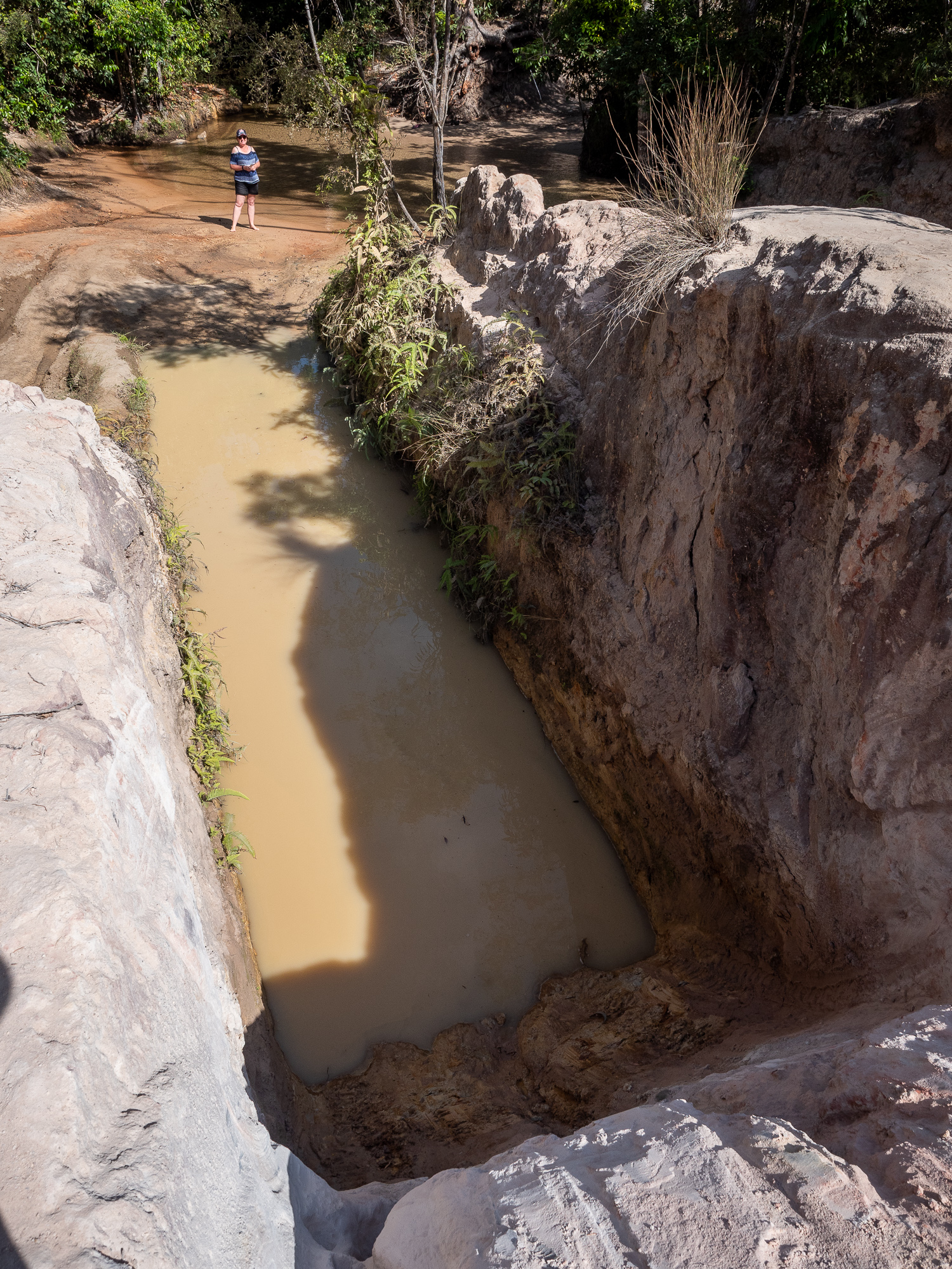
<< Photo credit: Tony – Looking down the 4mtr vertical drop and run out of one of the GunShot Creek crossings.. Not for the faint of heart, or shallow of pocket as there’s a good chance you’ll be needing some car repairs afterwards, although there’s always people attempting it. >>
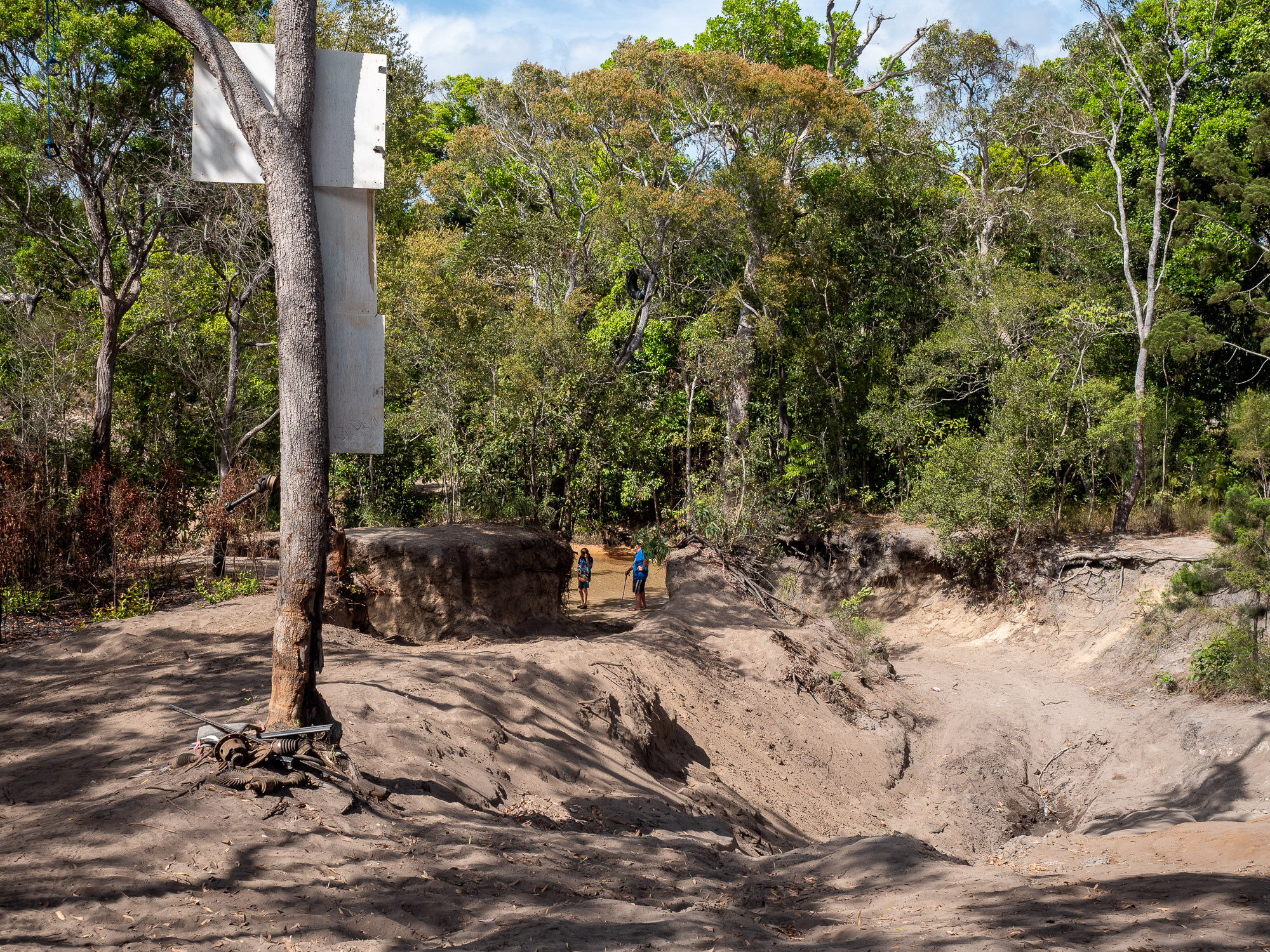
<< Photo credit: Tony – The track out of GunShot. If you get it right, you come up the left track (with the people standing in the entrance) and swing right, coming out on the other side of the tree which has a bunch of dead 4wd parts from previous failures. If you get it wrong, many people do, you miss the right hand turn and roll your car onto its roof in the right side track… >>
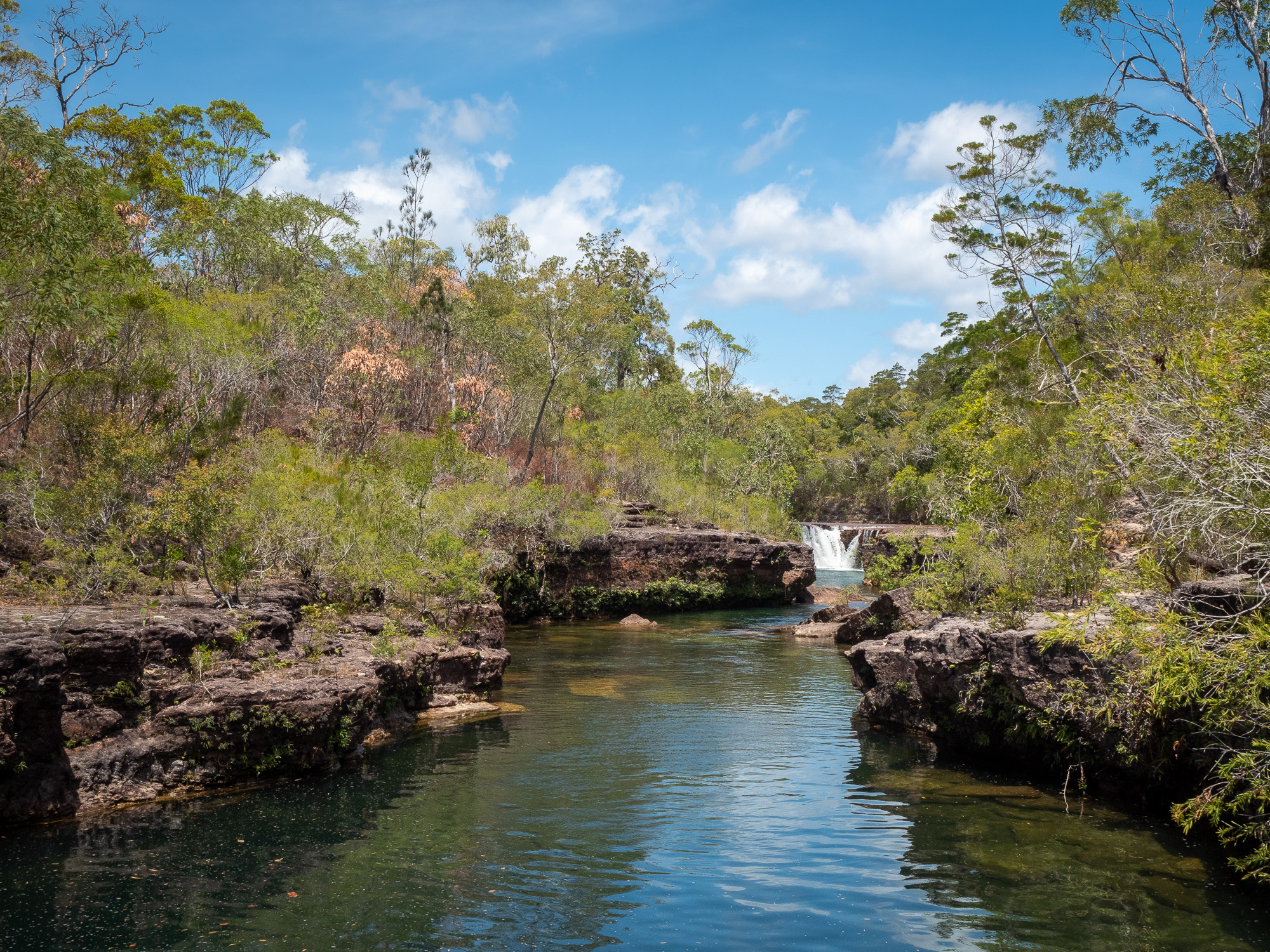
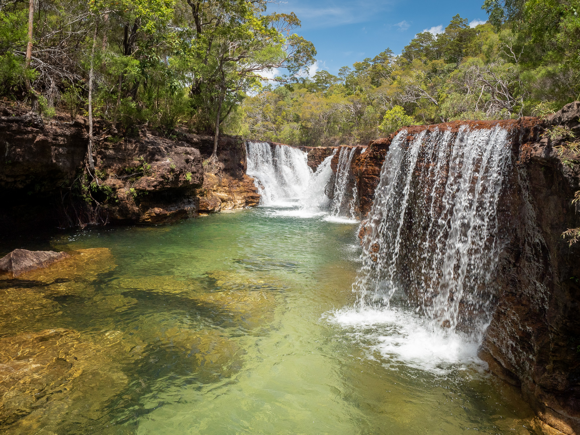
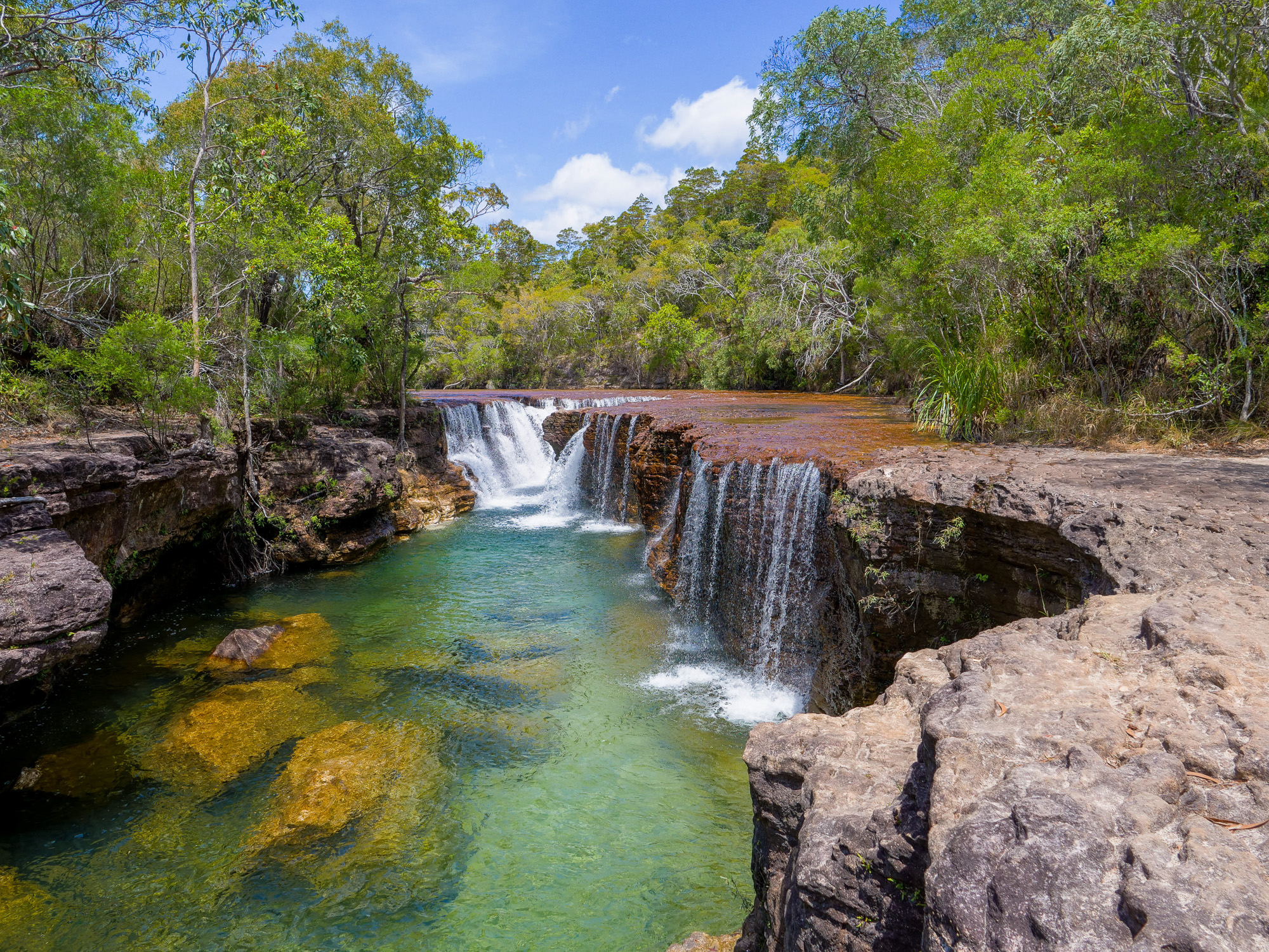
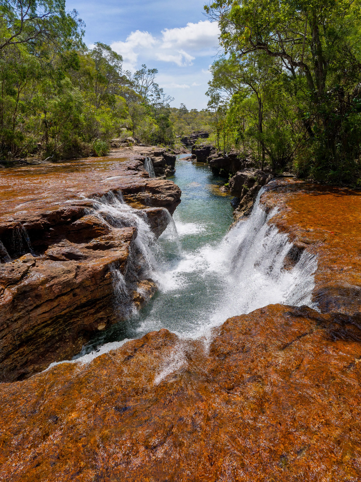
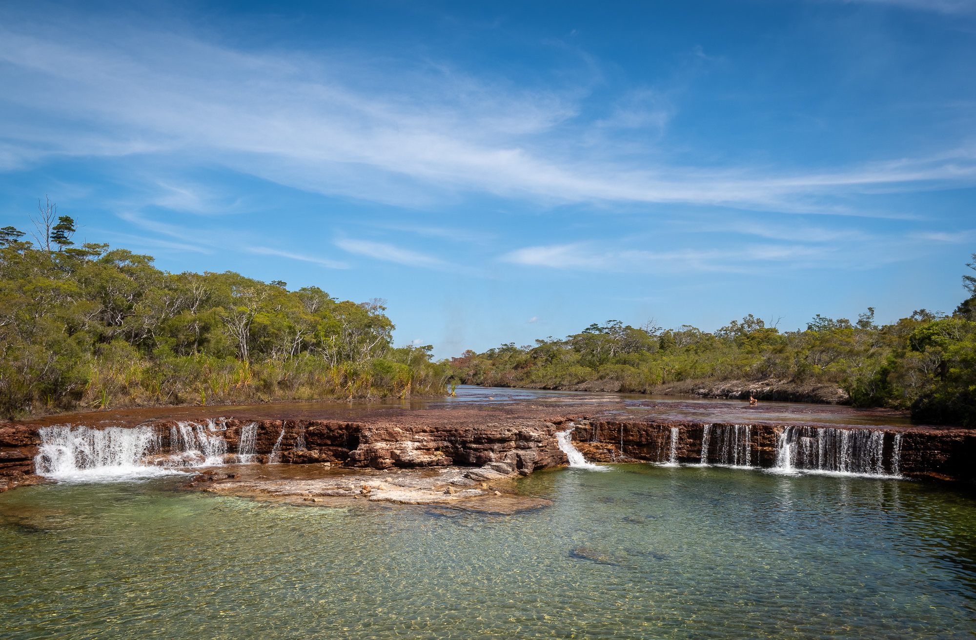
From Gunshot, we headed further north to Twin and Elliot Falls, both of which are awesome. Again, crystal-clear, warm water tumbling over plates of sandstone/granite, with plenty of sand patches for comfortable swimming. Without wanting to jinx the rest of our trip, so far, we’ve timed things to perfection, getting most places to ourselves, or at least having some ‘just us’ time at all the popular spots. So at Twin Falls we had a great swim and then took some postcards, (photos), before heading slightly south to the more popular and well-known Fruitbat Falls. Funnily enough, Fruitbat Falls looked just like all the pics we’d seen of it and again, after sharing a swim with about 10 others, they all buggered off, leaving the falls to just us. Perfect. More swimming and photos ensued.
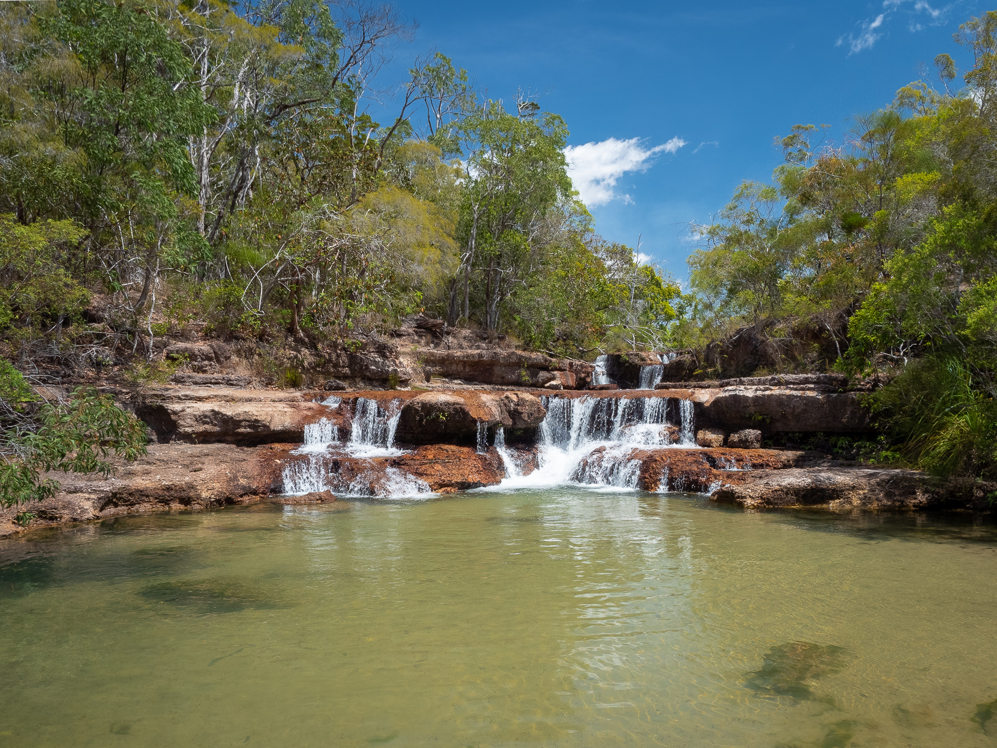
<< Photo credit: Tony – Twin Falls >>
<< Photo credit: Tony – Elliot Falls >>
<< Photo credit: Tony – Elliot Falls >>
<< Photo credit: Rod – Elliot Falls >>
<< Photo credit: Rod – Looking back over Elliot Falls and the large plates of sandstone/granite >>
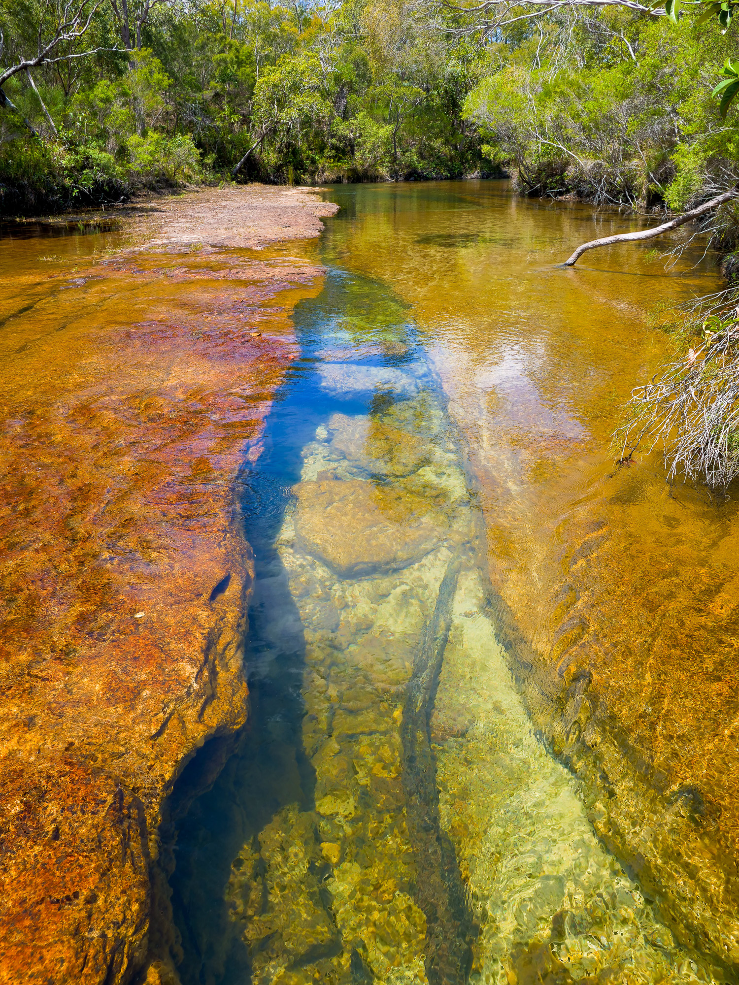
<< Photo credit: Rod – One of the many worn out cracks in the sandstone/granite at Elliot (and Twin) falls >>
<< Photo credit: Tony – The wider, but not as nice, in our opinion, Fruitbat Falls >>
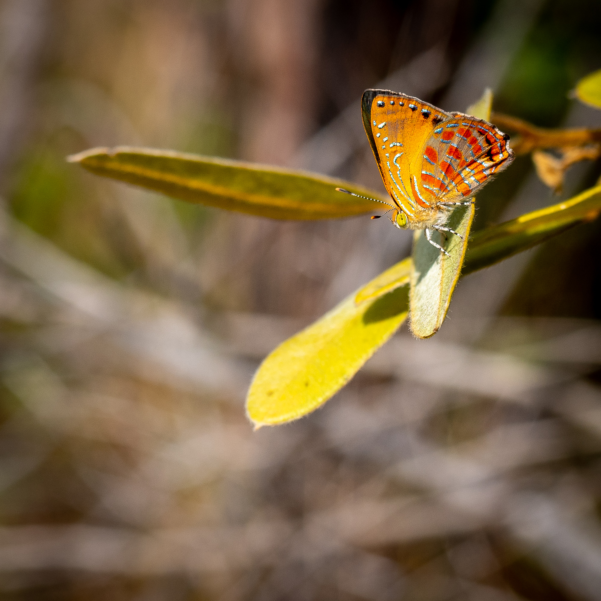
<< Photo credit: Tony – A nice coloured butterfly on the track out from Fruitbat Falls >>
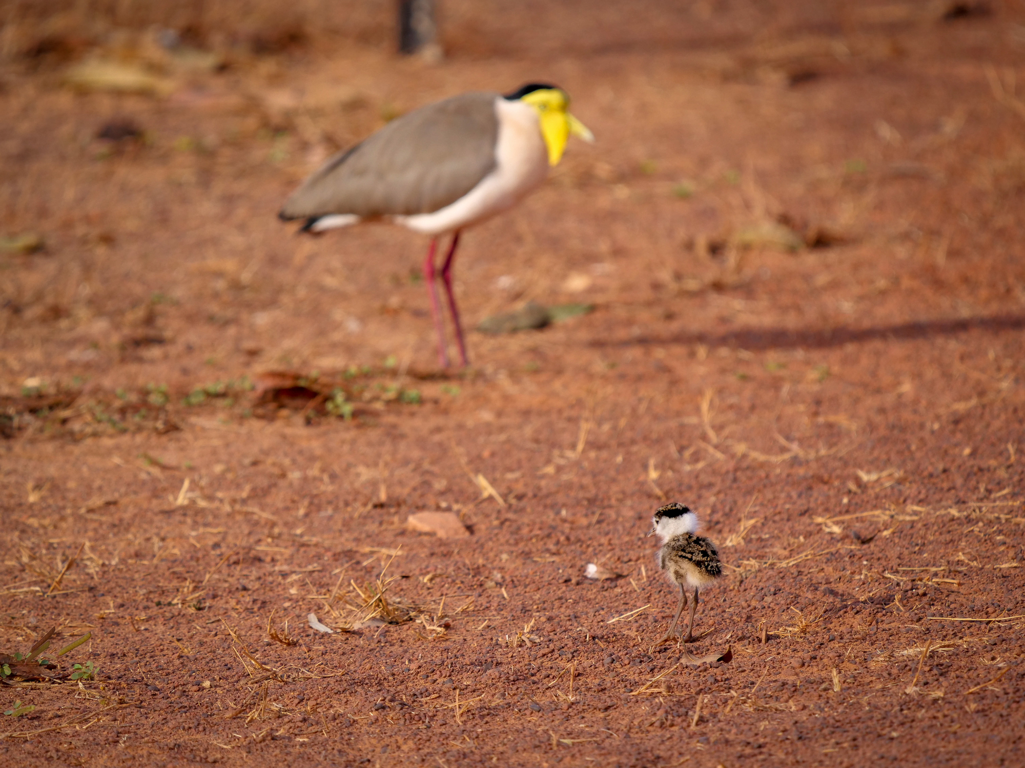
<< Photo credit: Rod – A Plover Chick and its parent at Bramwell Station >>
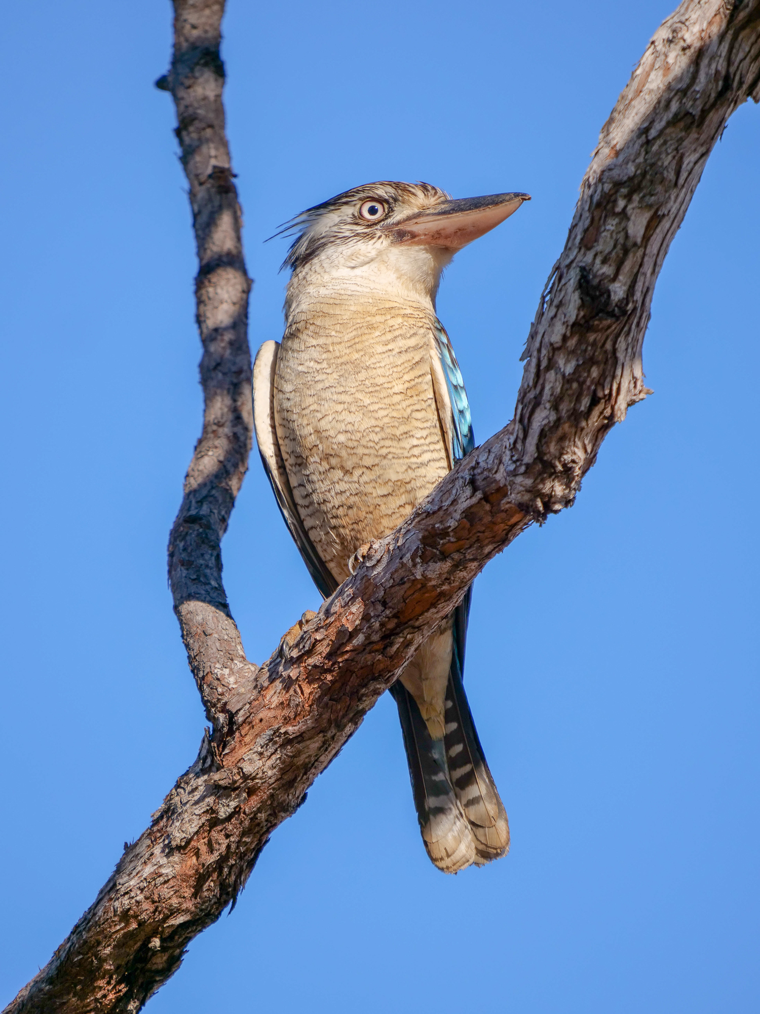
<< Photo credit: Rod – Blue Winged Kooaburra at Bramwell Station >>
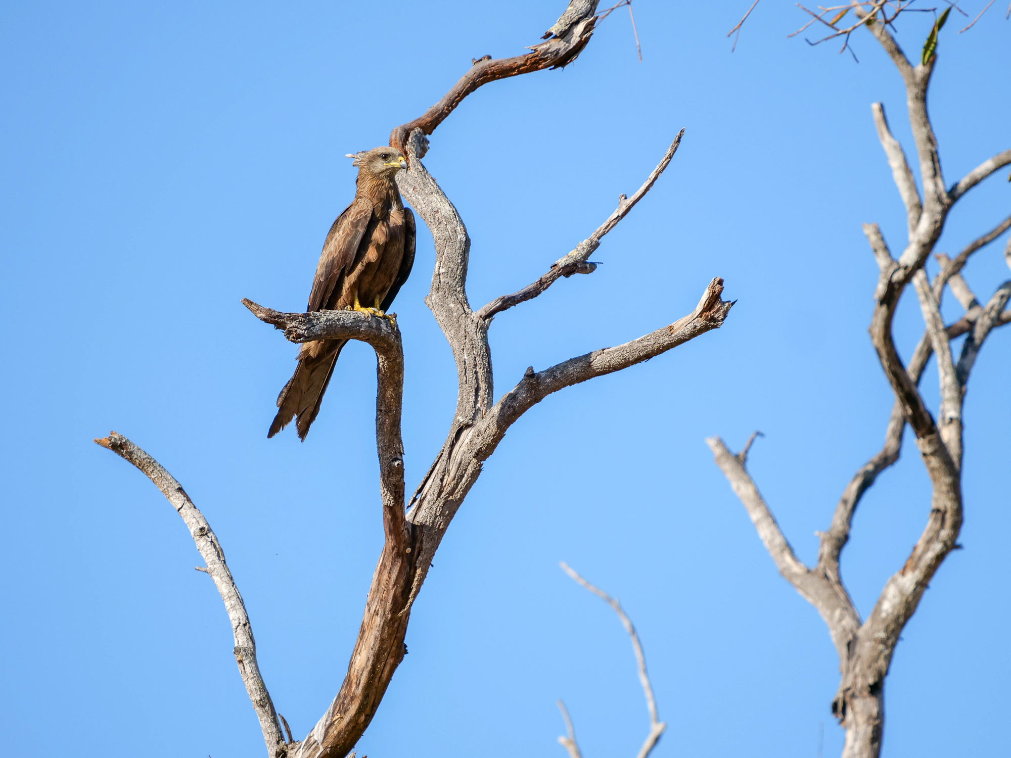
<< Photo credit: Rod – Whistling Kite that Rod was enticing to swoop, using Burger Rings, so he could photograph a swoop in action, at Bramwell Station >>
Monday, 10th Sept and we we’re off again, this time heading the remaining 240kms north up the PDR to our camp at Loyalty Beach, approx. 30kms south of The Tip itself. Loyalty Beach is on the western, gulf side, of the peninsula and as we’re were camping on unpowered sites, we could park our arses anywhere. So, we picked a beachside camp with views to die for. Our only real beef with Loyalty was the wind, which wasn’t their fault, and the resultant dust, again, not really their fault but we had to attribute our whinge about the wind and dust to someone.
As we’d arrived early, we spent the arvo doing some shopping at Bamaga, the local community town, before settling in for a home cooked roast dinner. Everyone says the sunsets over the gulf are fantastic and we’d assumed that’s because the majority of visitors are East Coasters who’ve never seen a sunset over the ocean before, but they were right, and we were treated to two absolutely beautiful sunsets.
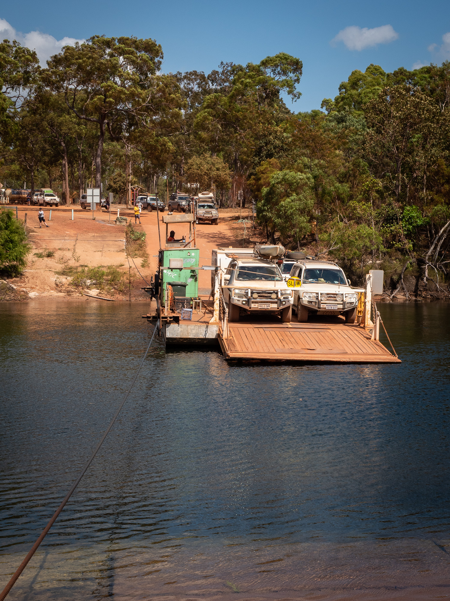
<< Photo credit: Tony – Rod and BJ on the expensive ferry across the Jardine River. $130 return…. >>
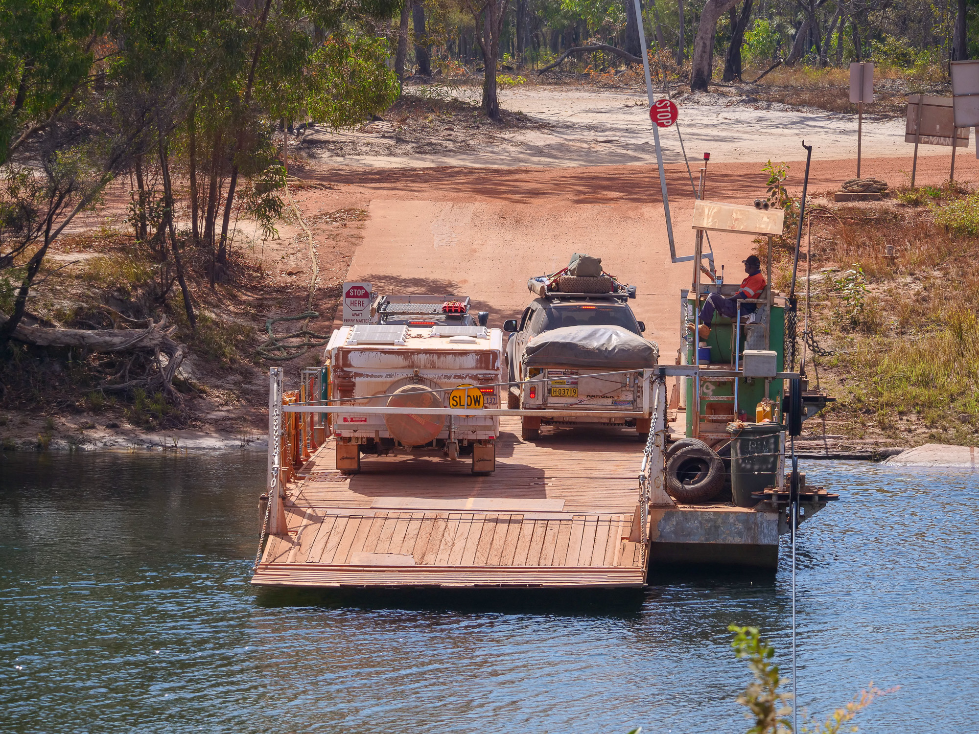
<< Photo credit: Rod – Goldy, our van on its trip across the Jardine River, looking a but dirty and dusty now.. >>
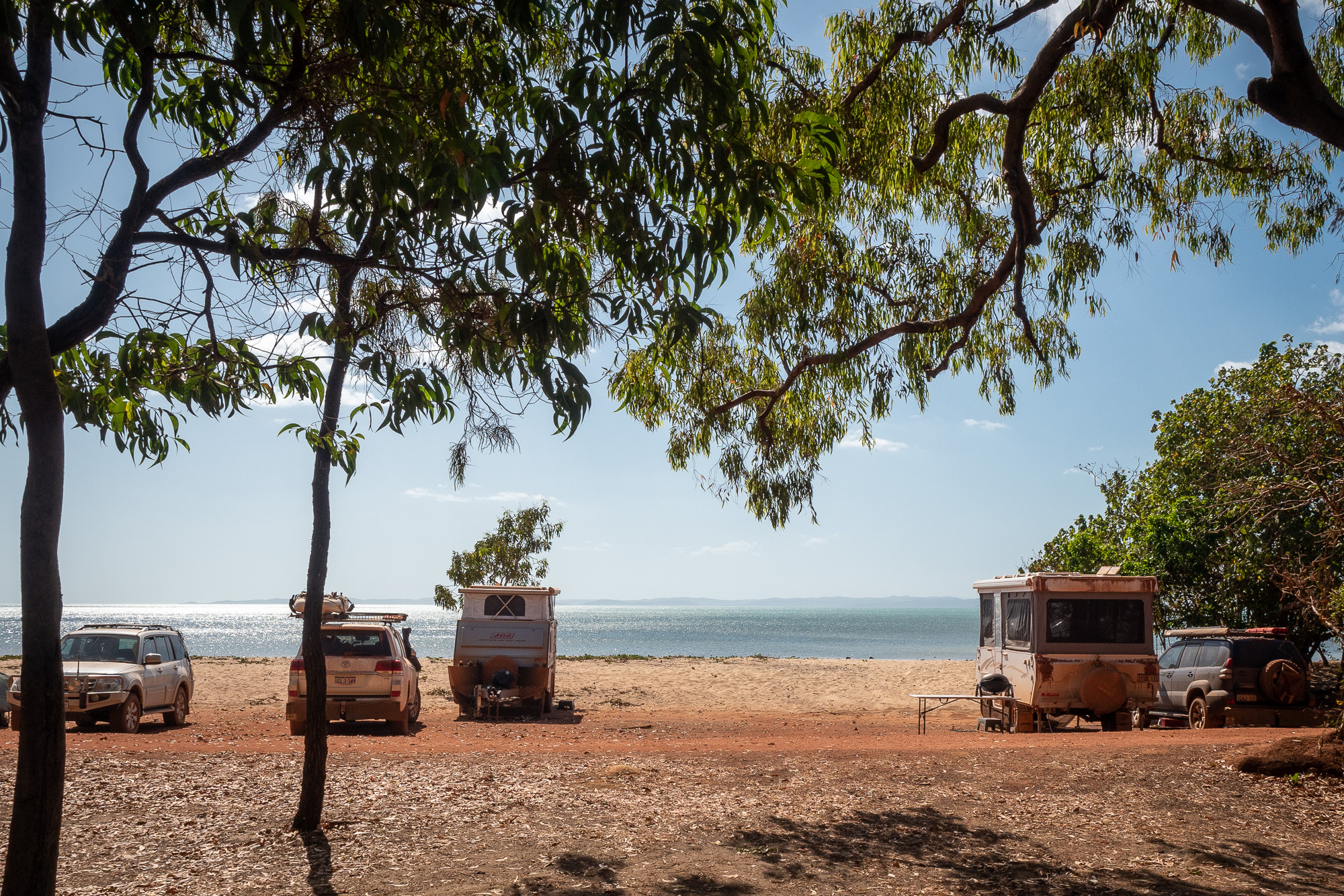
<< Photo credit: Tony – Our ocean front campsite at Loyalty Beach >>
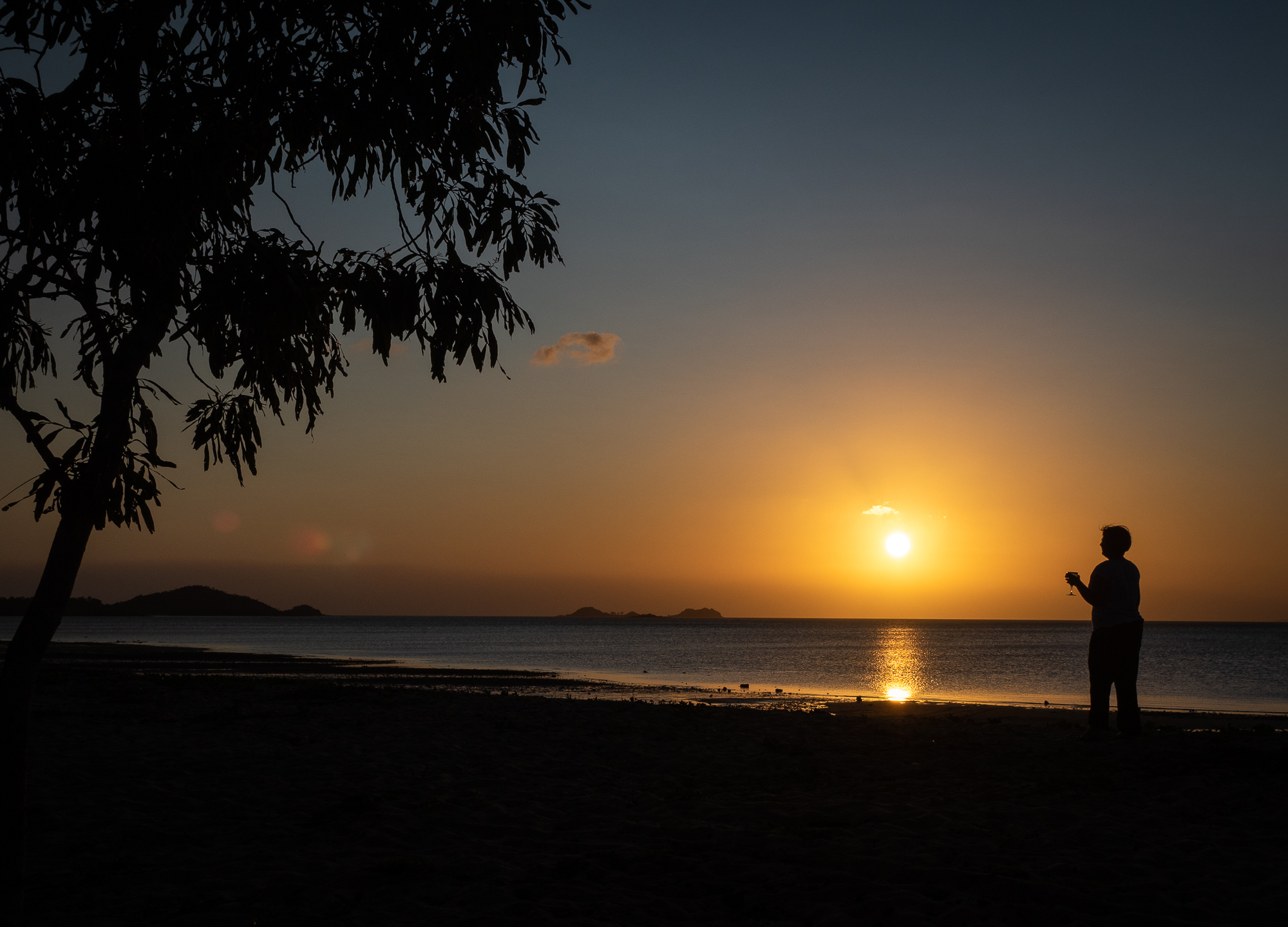
<< Photo credit: Tony – Jules enjoying a glass of wine and the sunset at Loyalty Beach >>
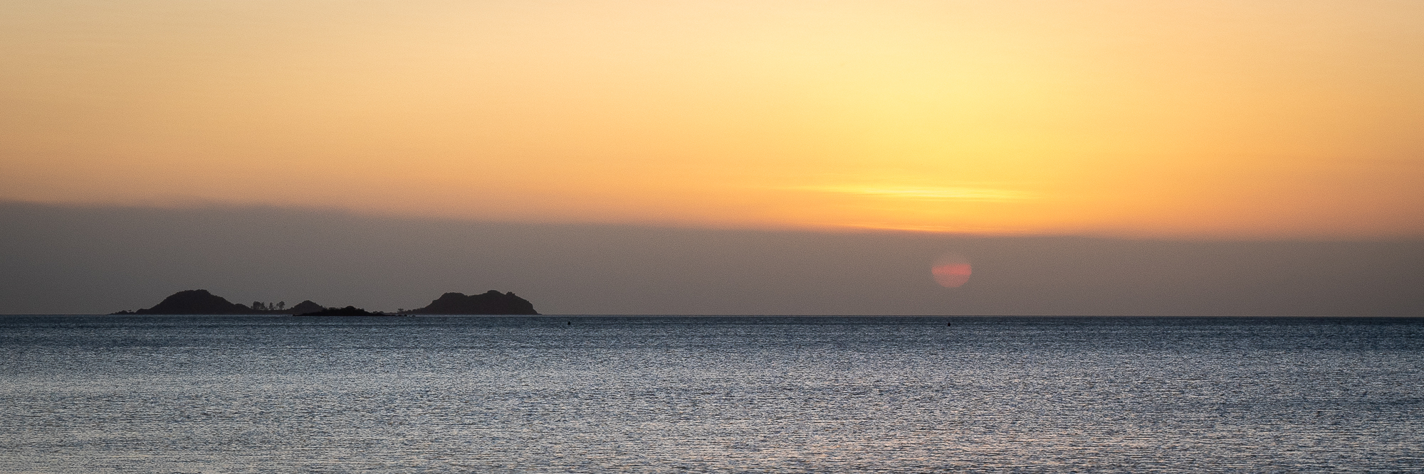
<< Photo credit: Tony – The sun dropping into a bank of smoke haze from all the controlled burns, at Loyalty Beach >>
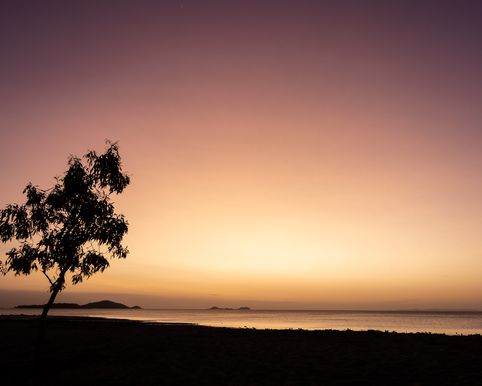
<< Photo credit: Tony – The sunset afterglow, straight from our campsite at Loyalty Beach. BJ’s van is literally 50cm out of the left hand side of this pic >>
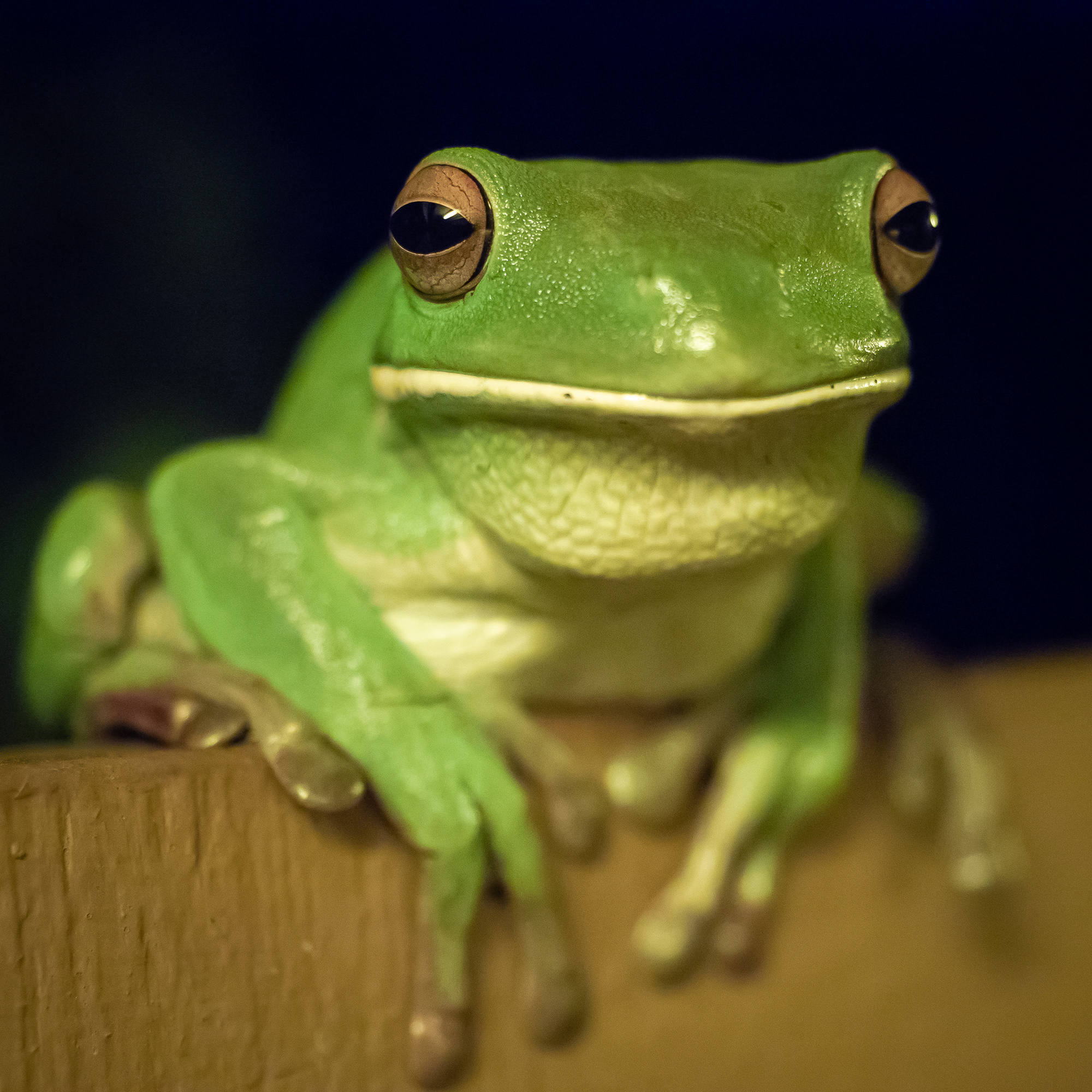
<< Photo credit: Tony – One of the many, large White Lipped Green Tree Frogs cohabiting the toilet/showers at Loyalty Beach >>
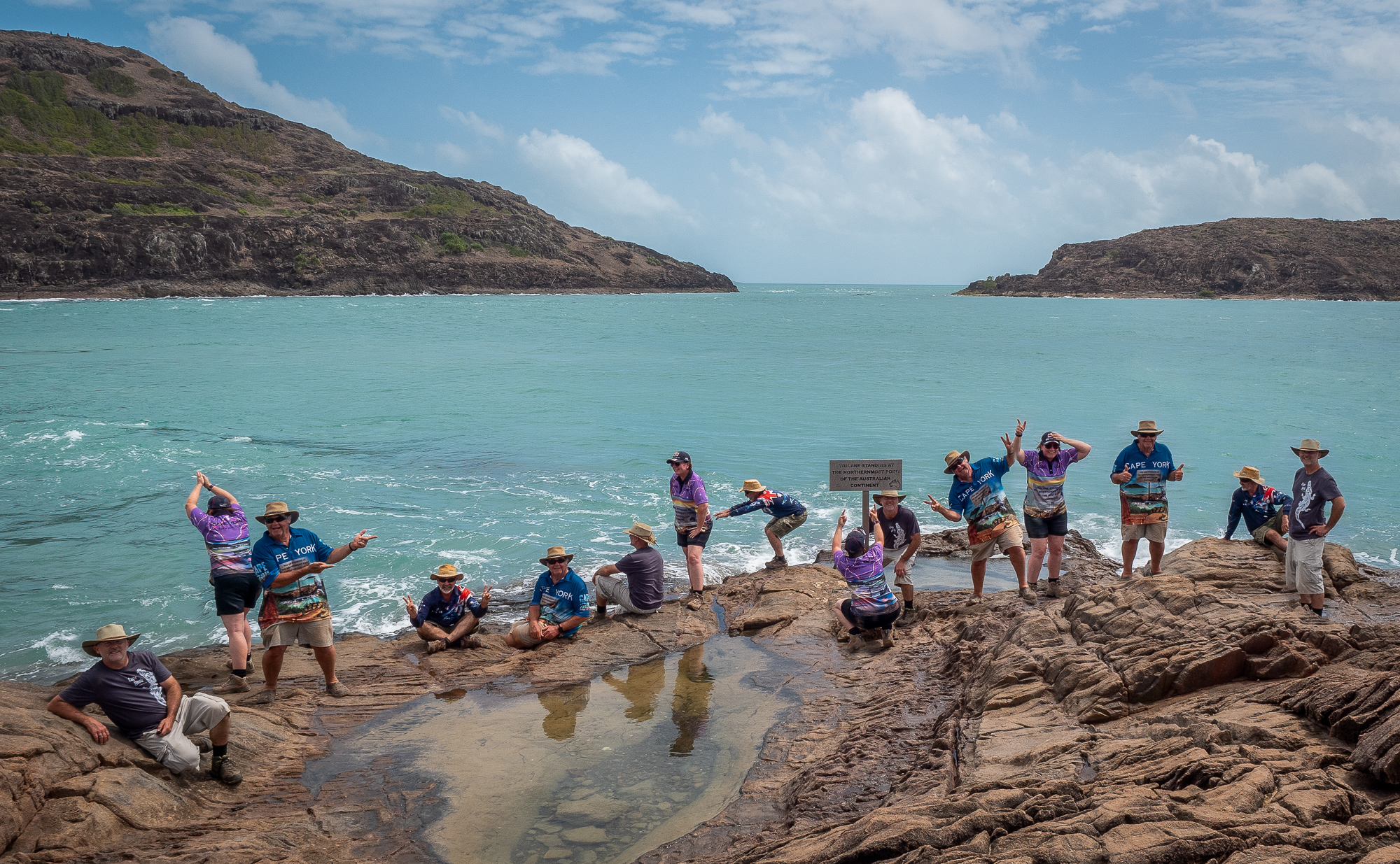
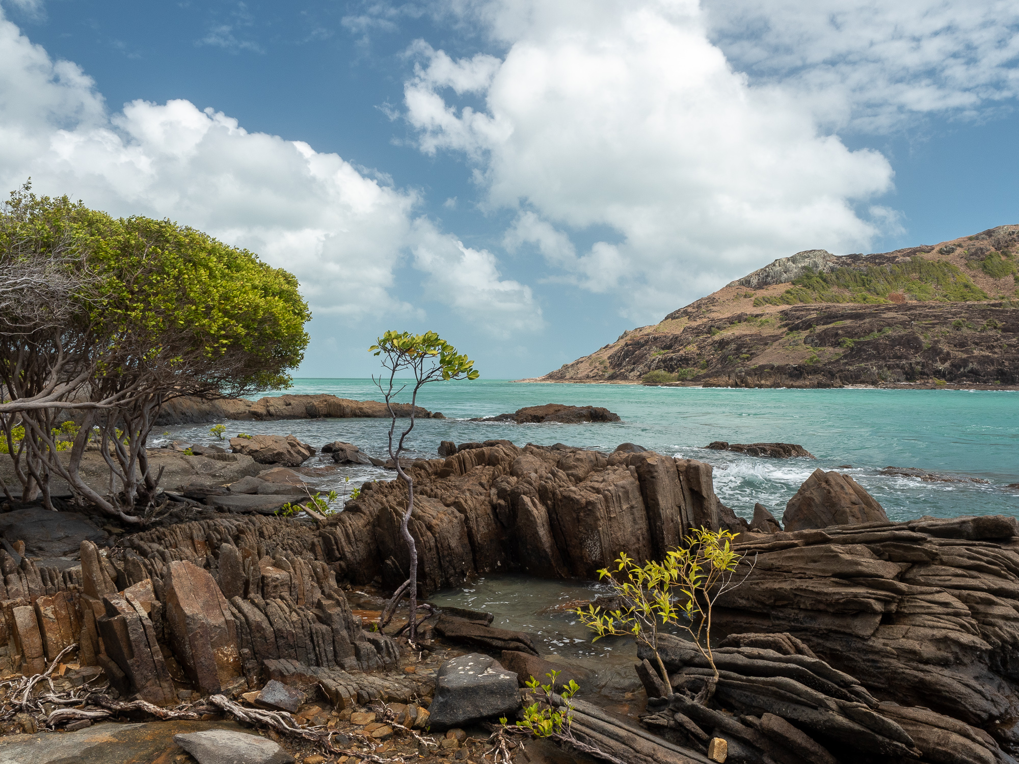
Now, for the moment we’d all been waiting for, drum roll please… Tuesday, 11th Sept and the day had arrived when we’d officially make it to “The Tip”. Stopping in at the Croc Tent en-route for Cape York merchandise, we clambered over the 500mtrs of rocky, and very windy headland, to the sign proudly proclaiming that we were now standing at the northern most tip on mainland Australia. That you could actually stand a few metres behind, north, of this sign without getting wet meant that the sign was actually lying, however, standing that close to the water meant you were effectively presenting yourself as ‘Croc Entrée’, so we’ll let the sign-writers off. Again, we timed things perfectly, arriving just as another family were leaving, giving us nearly 30mins of ‘us time’ to do all our typical, and stupid, pics at The Tip. As expected, The Tip itself isn’t particularly scenic or interesting, but we can now at least claim to have done it.
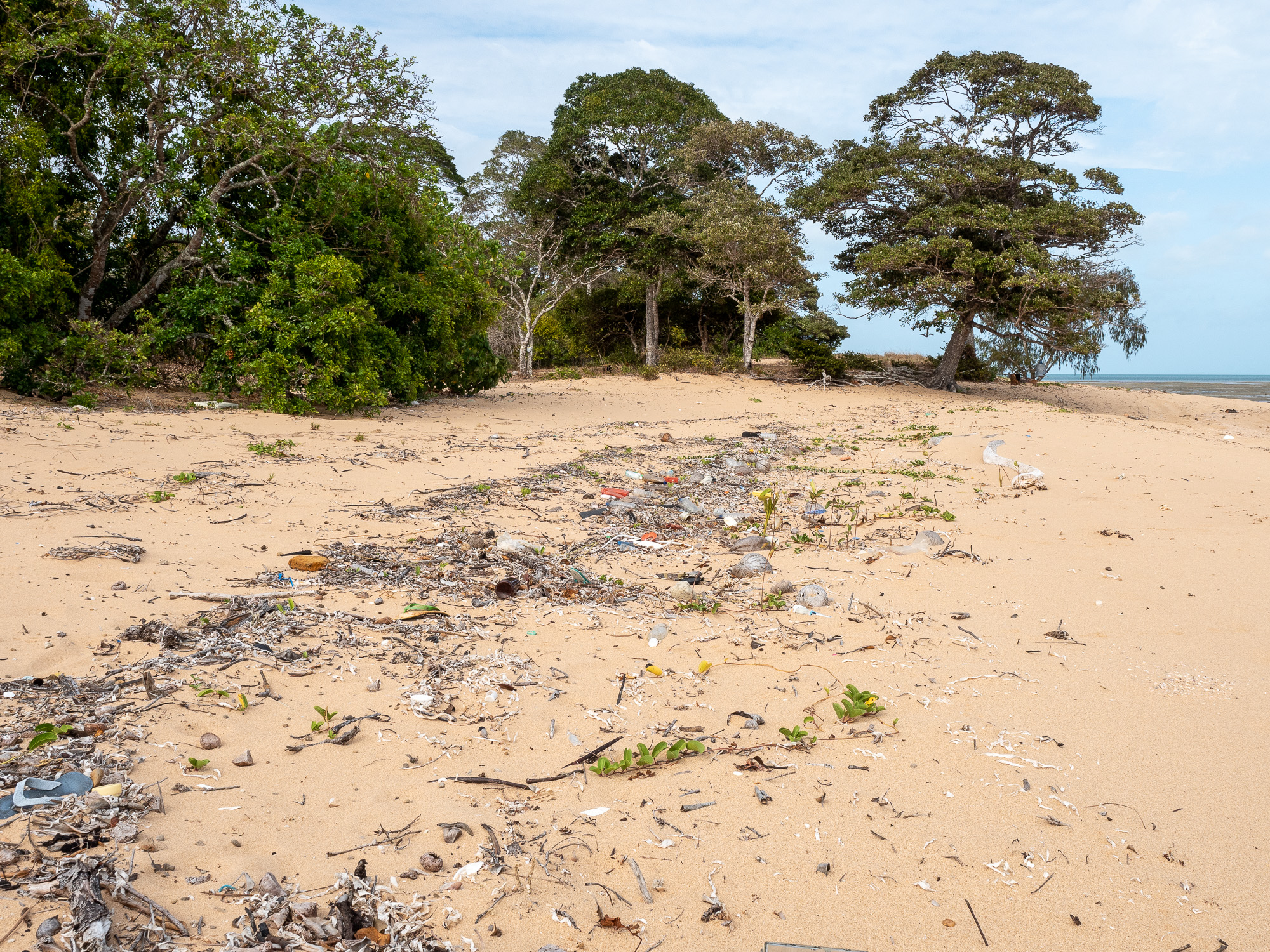
<< Photo credit: Tony – Not every scene was a postcard however… This is one of many beaches, this one near Patterson Hill, that is covered in rubbish.. >>
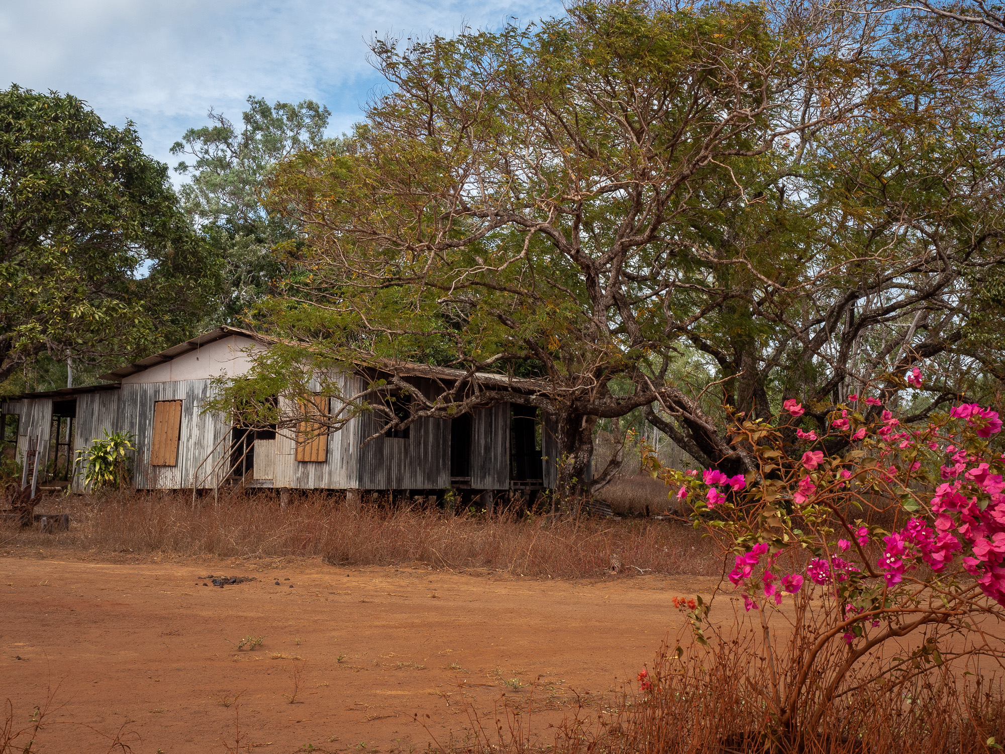
<< Photo credit: Tony – The old shed/house opposite the Croc Tent >>
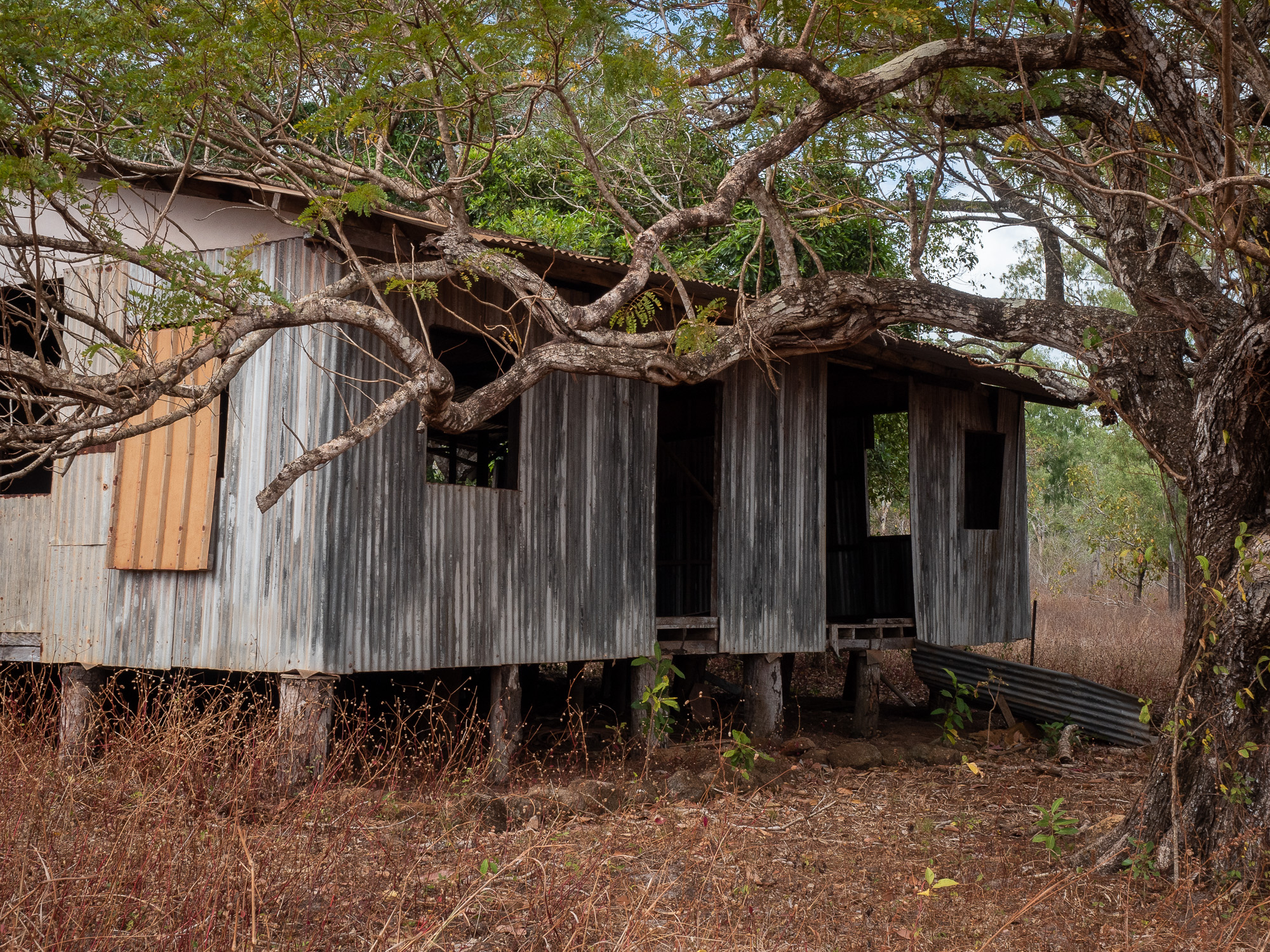
<< Photo credit: Tony – The old house/shed opposite the Croc Tent >>
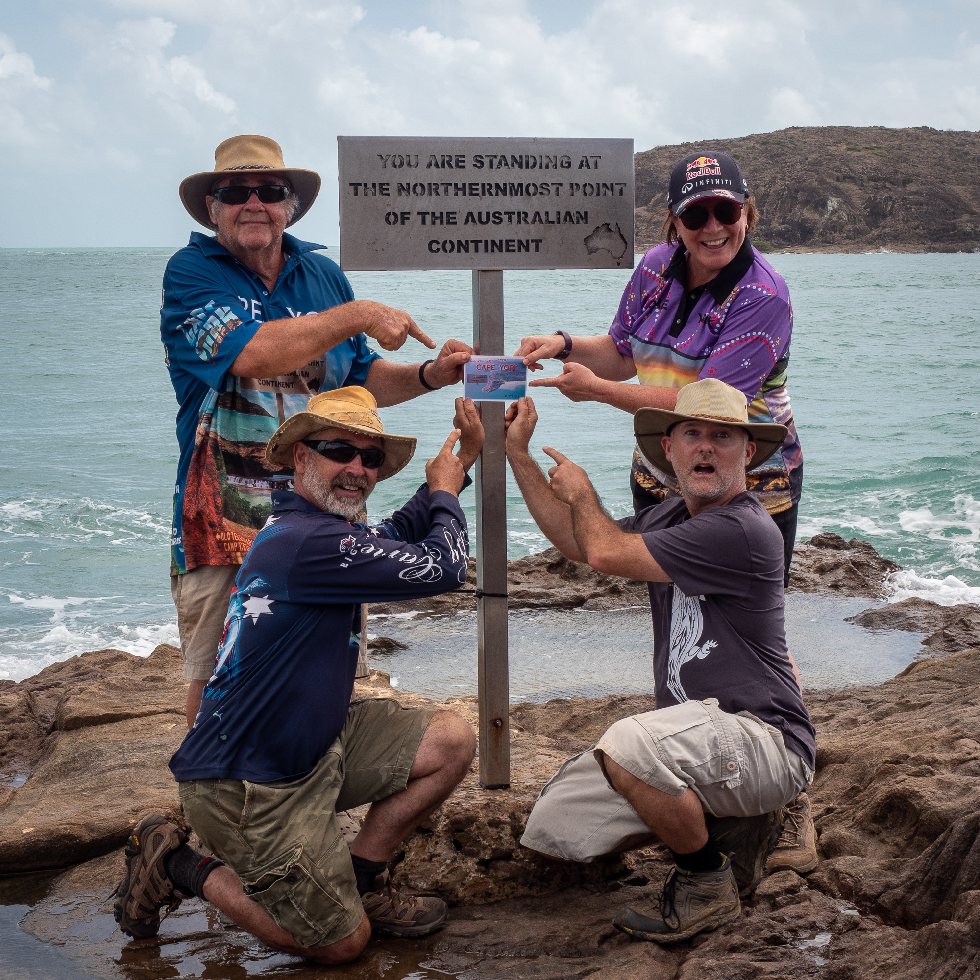
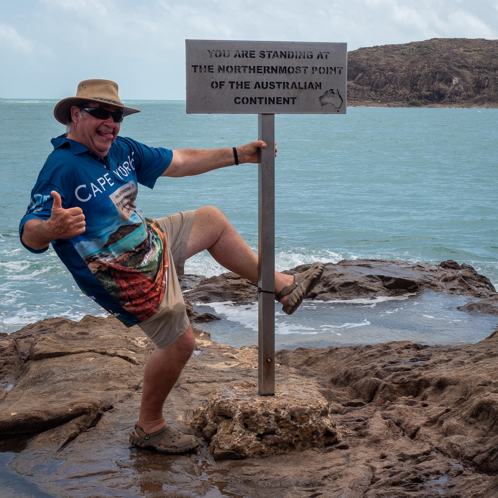
<< Photo credit: Tony – Our novelty “At the Tip” pic we posed for >>
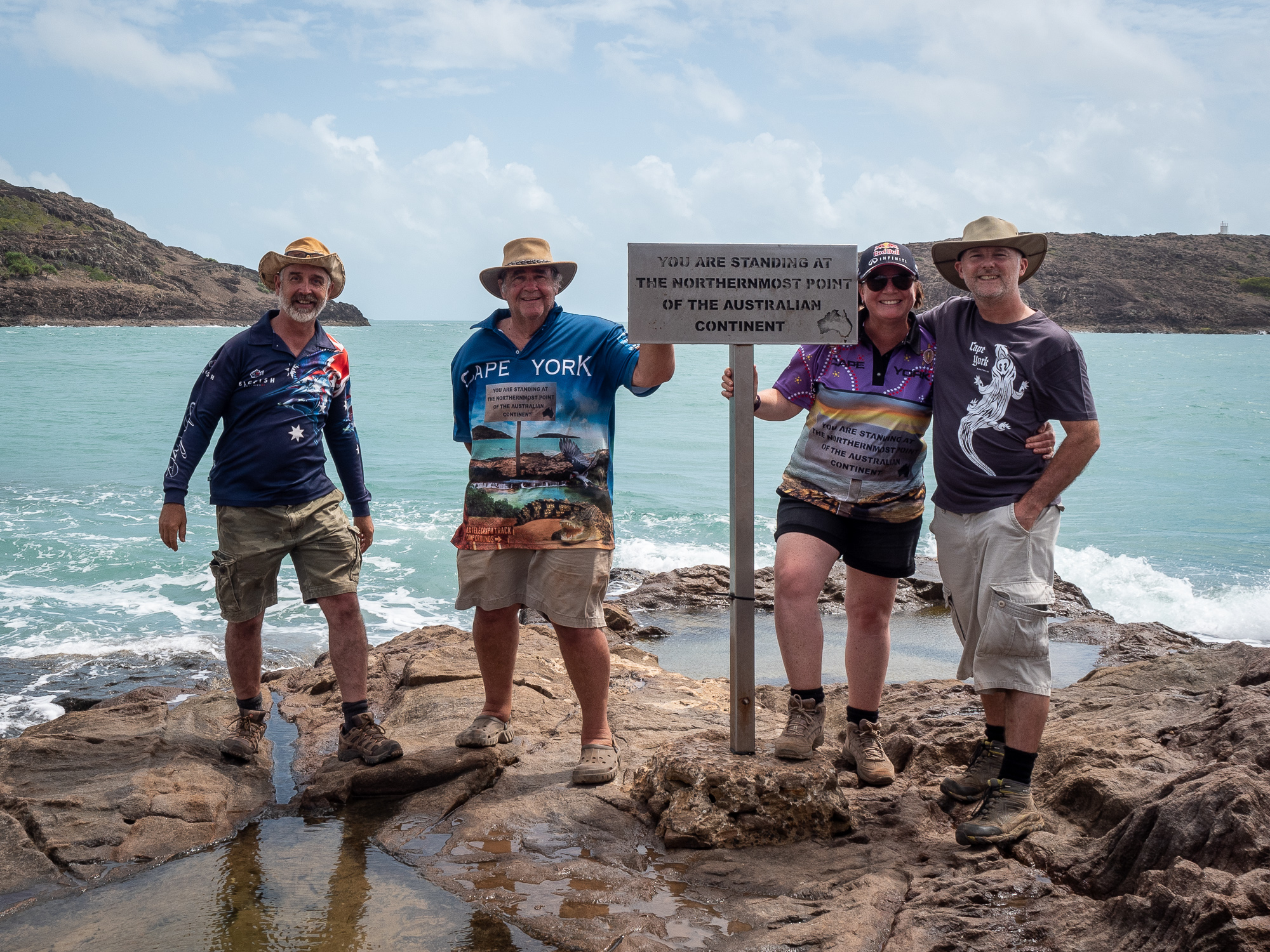
<< Photo credit: Tony – The routine, and boring, “The Tip” photo everyone needs to do >>
<< Photo credit: Tony – Our “Postcard” shot, just for Paul Utting. Cost me $1.50 for that bloody postcard… >>
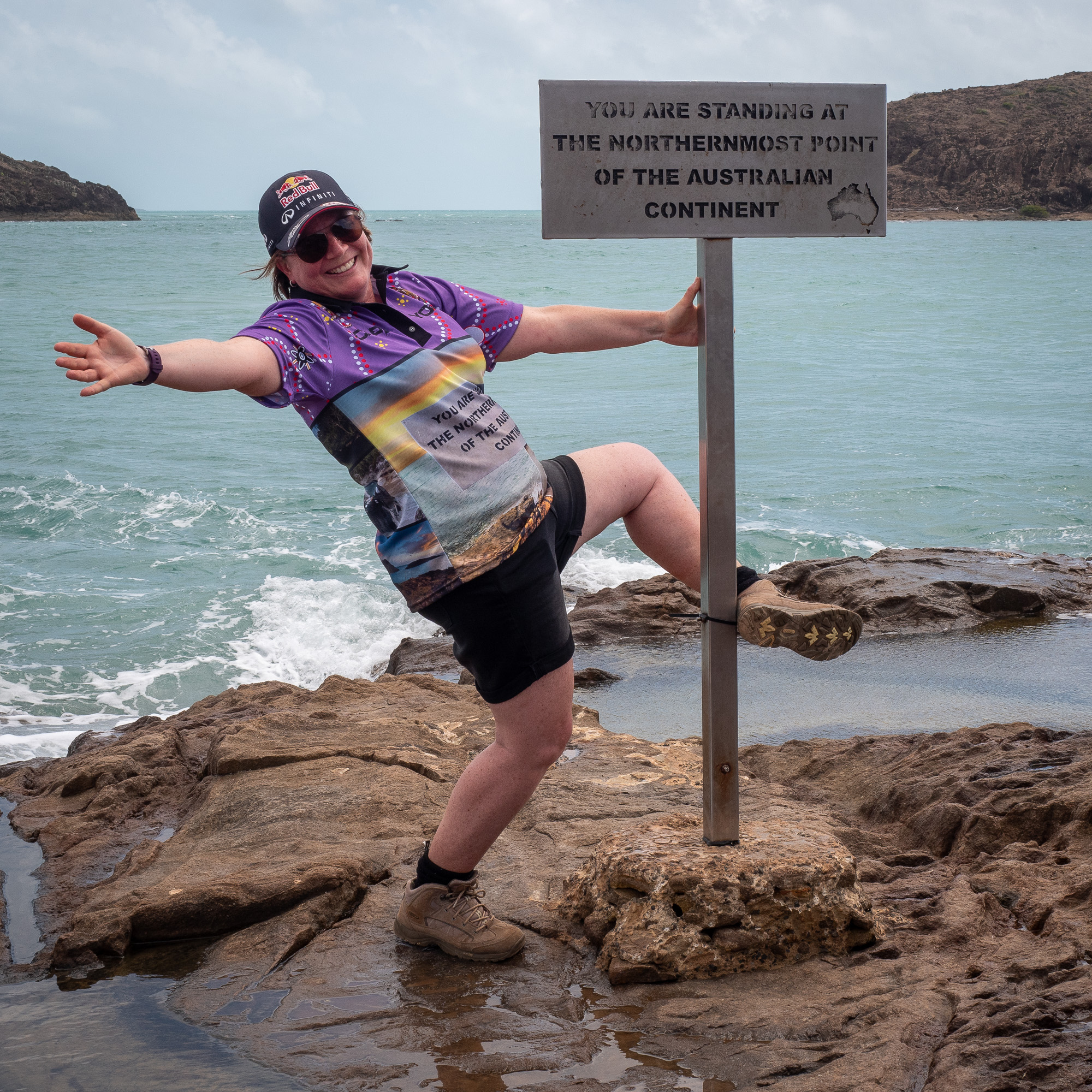
<< Photo credit: Tony – Jules pole dancing at The Tip >>
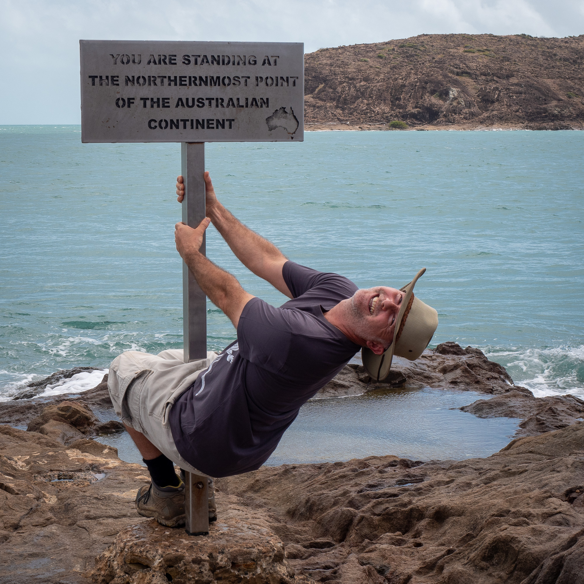
<< Photo credit: Tony – Tony pole dancing at The Tip >>
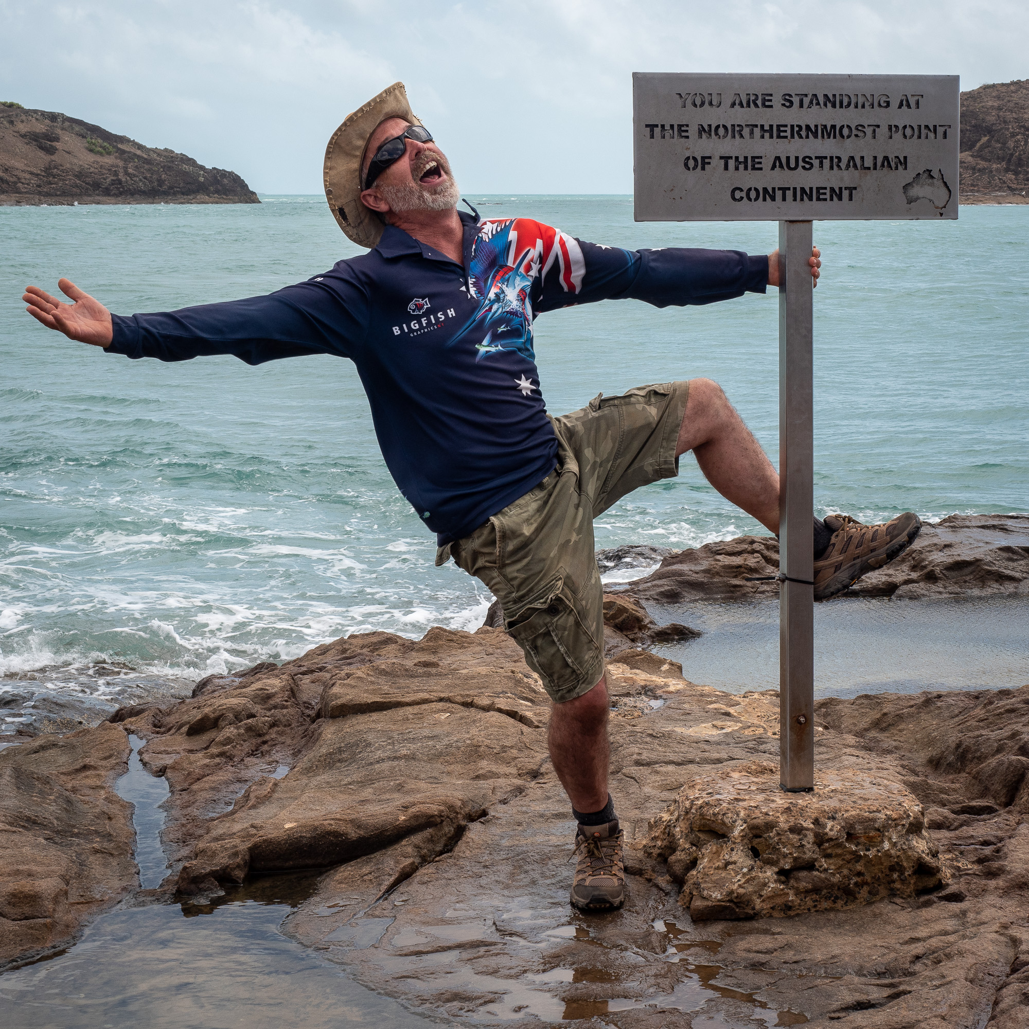
<< Photo credit: Tony – Rod pole dancing at The Tip >>
<< Photo credit: Tony – BJ pole dancing at The Tip >>
<< Photo credit: Tony – Another The Tip photo, this one taken a few metres to the left (west) of the sign >>
Following a cold roast beef and pickle sandwich, leftovers from the roast last night, accompanied by a beer, we headed back towards Bamaga to check out two World War 2 plane wrecks, including numerous old fuel dump sites, before heading out to Injinoo and Umagico, taking the back road from Umagico up Seisia, then out to Loyalty.
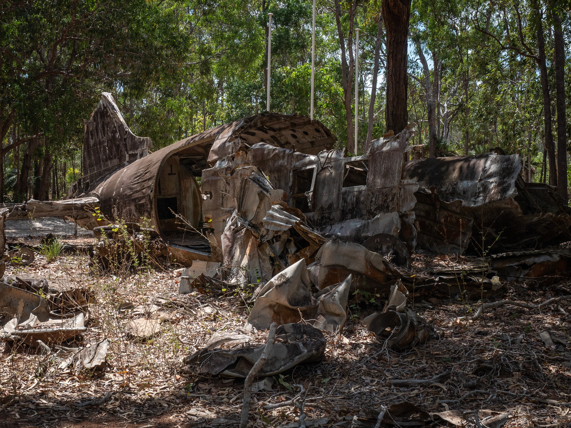
<< Photo credit: Tony – The wreckage of the DC3 near Bamaga, in which 3 crew died when they crashed in 1945 >>
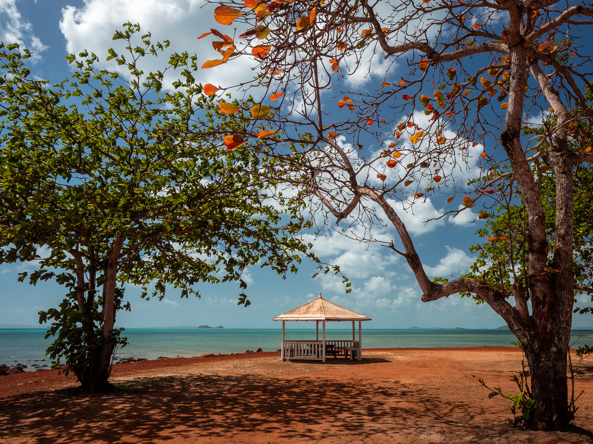
<< Photo credit: Tony – The unexpected, but very beautiful gazebo at Injinoo >>
Celebrating todays efforts, we had dinner at the Loyalty Park beach bar which included a couple of bottles of white, some Buckets of Prawns and Spanish Mackerel and Chips.
<< Photo credit: Tony – The not so great sunset on our second night. This one taken from the Beach Bar at Loyalty Beach >>
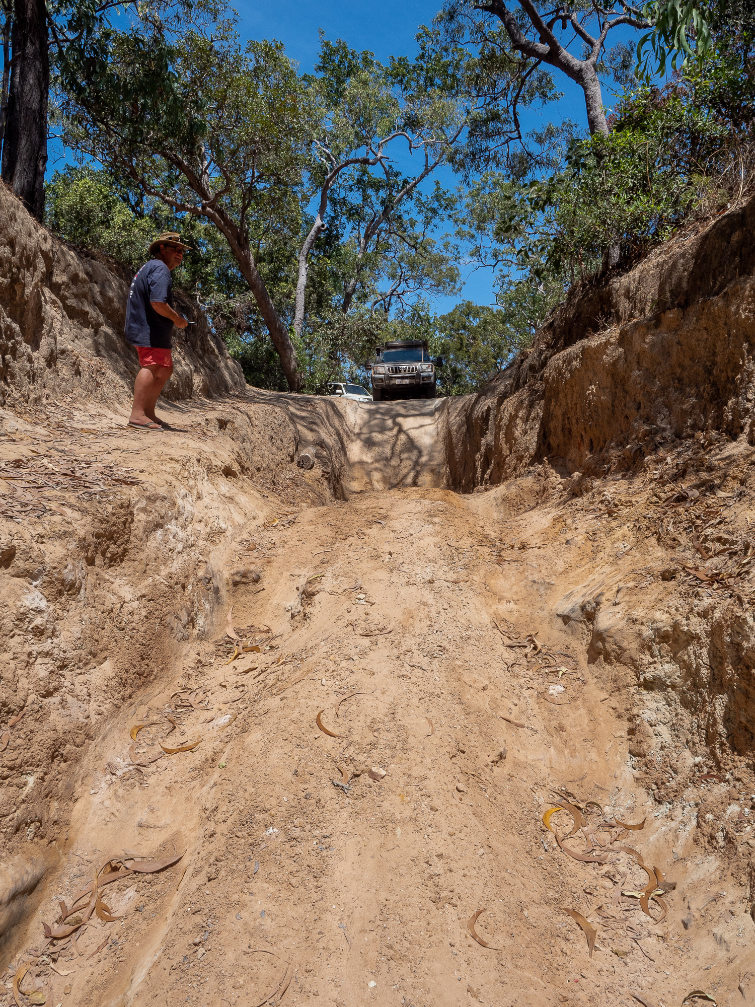
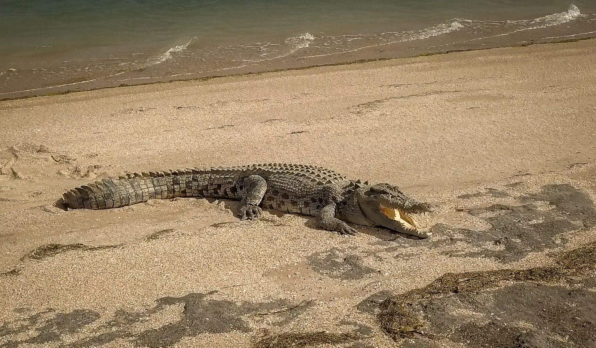
On our last day at Loyalty, Wed. 12th Sept, we did an early drive out to the historic Somerset site, just east of The Tip, before completing the Five Beaches 4wd track. At the exit of the 1st beach, Gary, our Prado, decided to have a little rest on the sandy track, even refusing to use the MaxTracks to get moving again, in the end requiring BJ’s winch to pull us back a metre or so, so we could get a run up at the sandy section. Gary was fine after that little faux pas, making the rest of the track without an issue. Despite the early start it was still pretty windy and the skies overcast, so the beaches weren’t looking their best, but Rod was happy as he did a bunch of drone work whilst we drove along which he’s turning into a short clip on his RocketWA YouTube channel. The highlight of the beaches drive (for me, Tony), was finding a Nautilus Shell on the beach, which I’ve carefully packed and hoping it’ll make it home in one piece. Before leaving Somerset, we detoured into a little fresh water lake where we saw our first, wild Saltwater Croc, some beautiful Lilly flowers and eagle eyes Budgie (me) spotted a wild White Lipped Tree Frog.
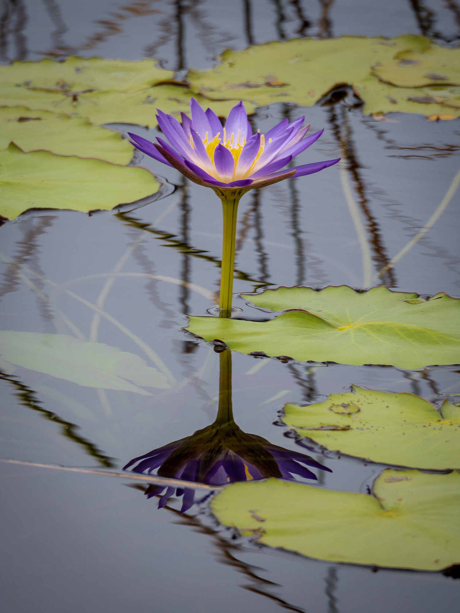
<< Photo credit: Tony – A lily in the freshwater lake near Somerset and the 5 Beachs 4wd Track. Unfortunately I couldn’t get closer to take a better shot as the lake has crocs in it, one of which we saw a few mins after taking this shot… >>
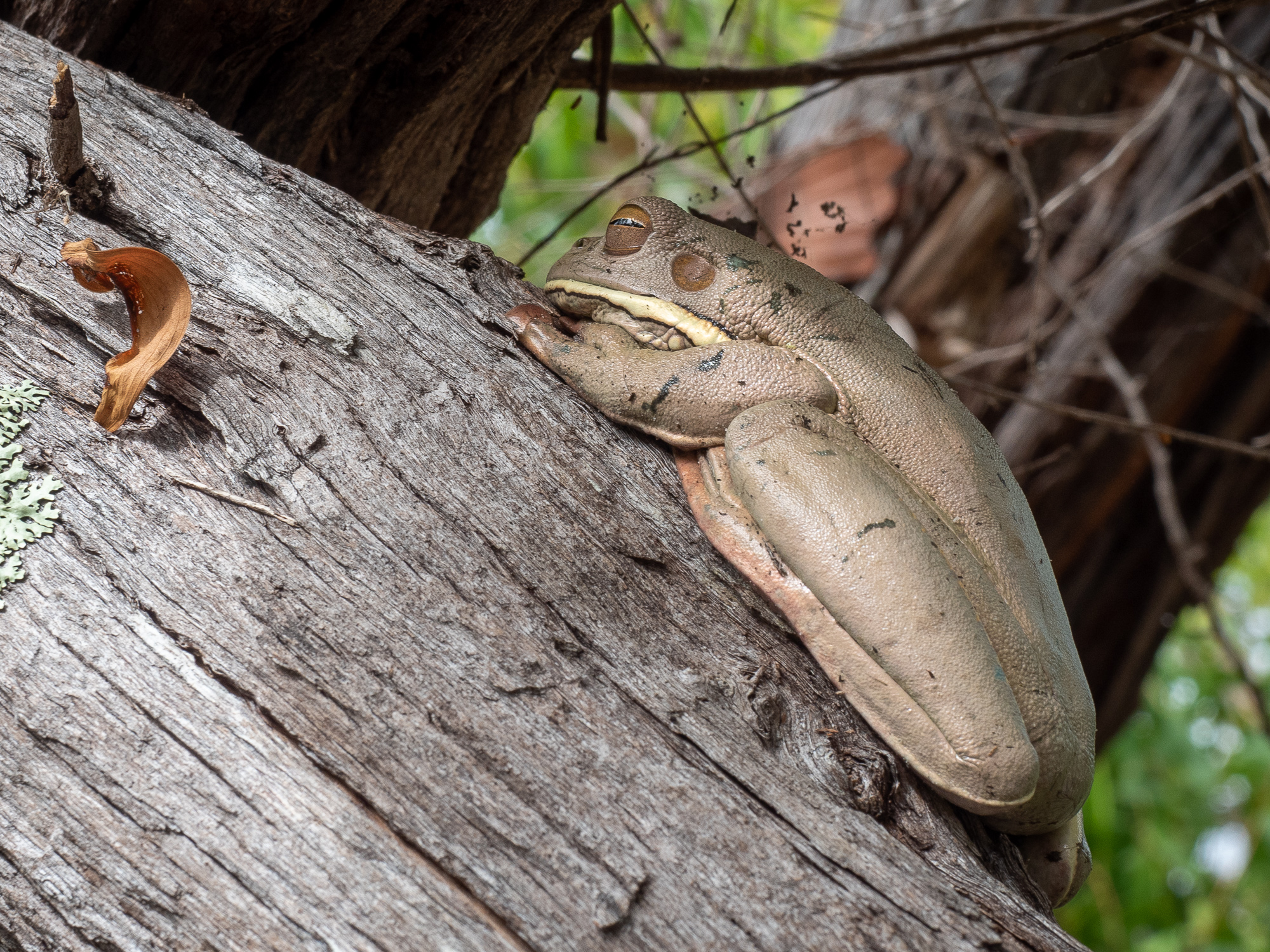
<< Photo credit: Tony – Our first wild White Lipped Green Tree frog near the freshwater lake >>
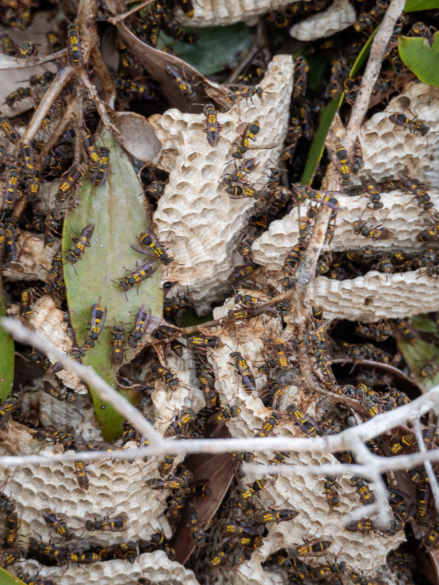
<< Photo credit: Tony – A native wasp, or possibly bee, nest near the freshwater lake >>
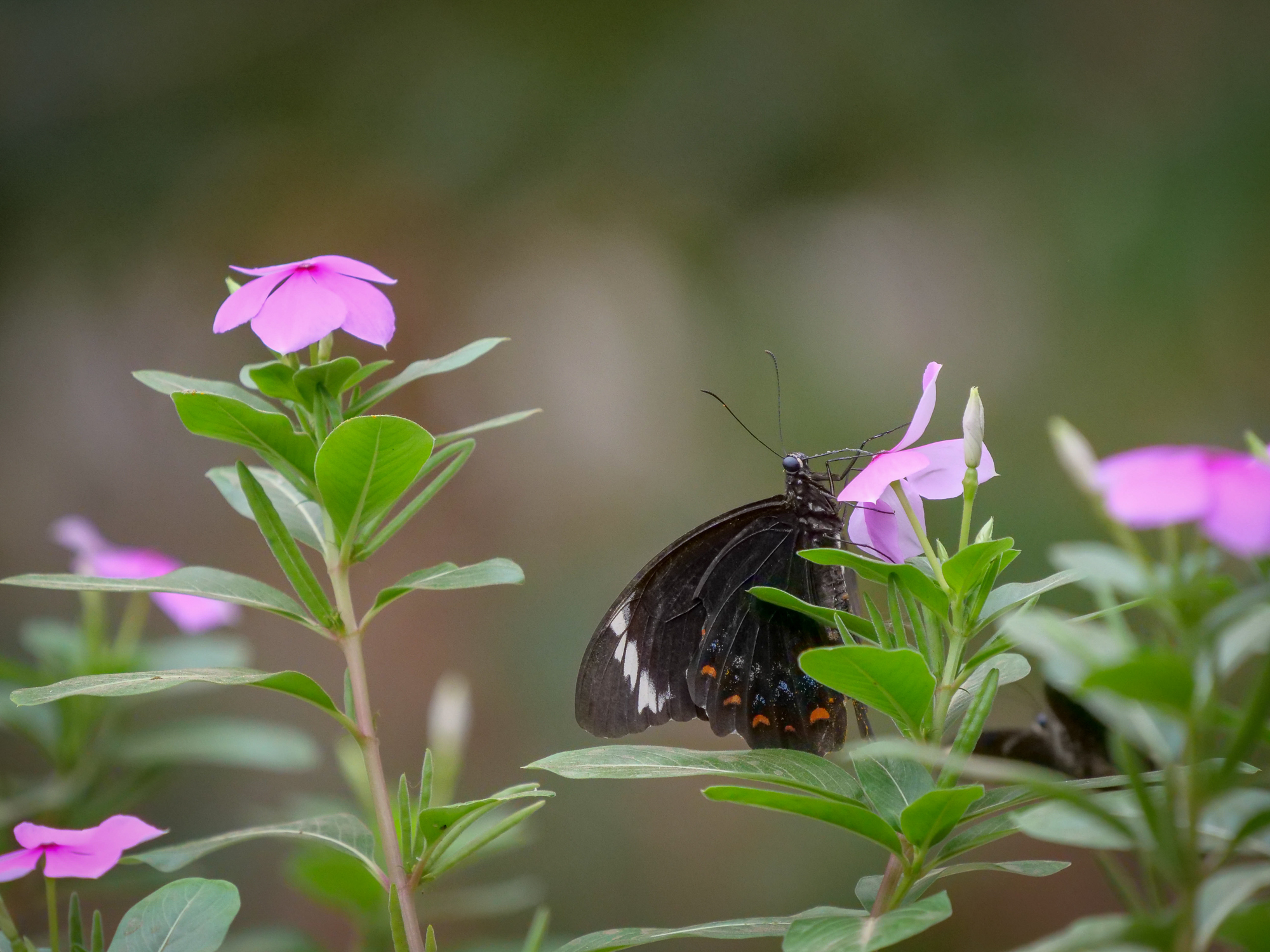
<< Photo credit: Rod – A butterfly at Punsand Campground >>
On the way back we dropped into Punsand Camping Ground for a quick look and a coffee on the way home, none of us being overly impressed with it, but the coffee was good, before heading back to camp for lunch. We also performed our car and van checks to ensure everything was ridgy-didge (ok) for the start of our trek back south tomorrow. Rod, BJ and I then spent a couple of hours trying our luck chucking lures at the Seisia jetty but only managed a couple of short hook-ups with Longtoms (which we didn’t want to catch), before BJ and Rod spotted a largish, around 3mtr Saltwater Croc beach itself on the island across the channel. Rod quicky dropped the fishing gear and droned him as well so subscribe to his RocketWA YouTube channel for that masterpiece. Finishing the day, Rod and I then walked a couple of kms up the beach to photograph an old boat, marooned in the sand.
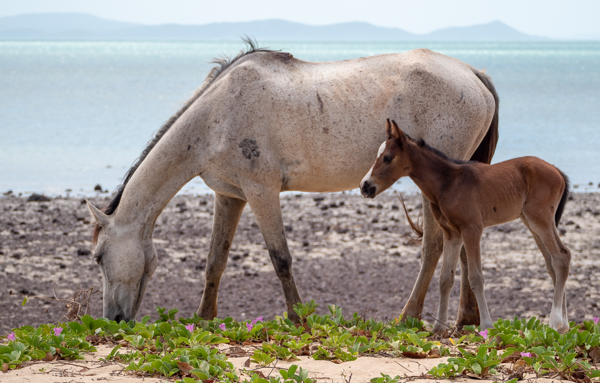
<< Photo credit: Tony – Some brumbies (wild horses) that strolled up onto our beach at Loyalty Beach to eat that green vine >>
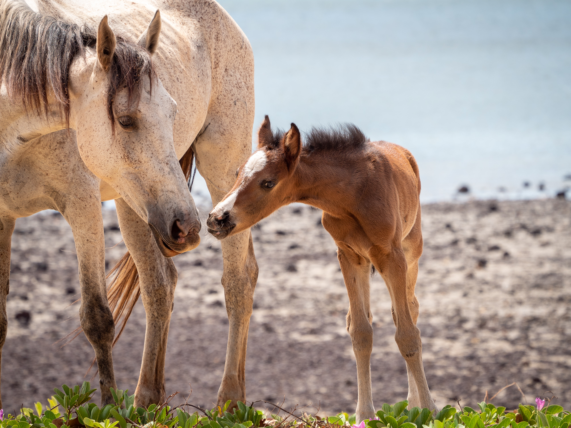
<< Photo credit: Tony – Mum and foal at Loyalty Beach >>
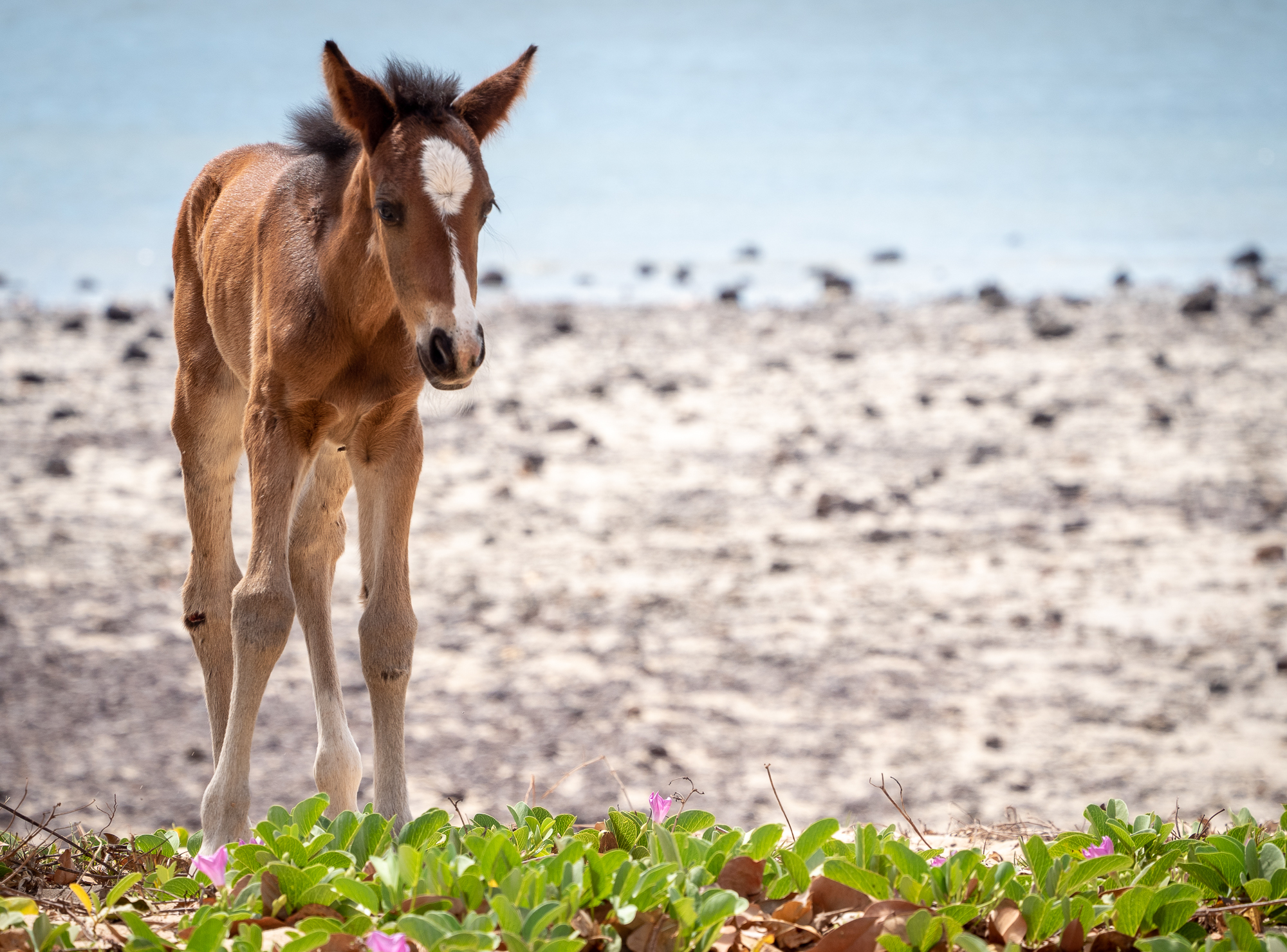
<< Photo credit: Tony – All legs, a brumby foal at Loyalty Beach>>
<< Photo credit: Rod – A snapshot taken from Rod’s drone footage of what we believe was a 3mtr’ish Salterwater Croc that was on the beach across from the Seisia Jetty >>
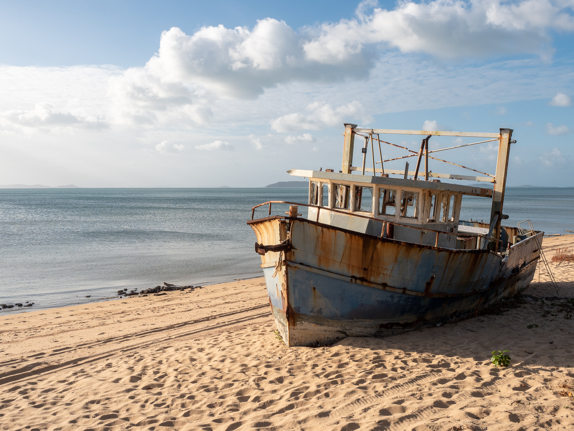
<< Photo credit: Tony – The old marooned boat, just north of Loyalty Beach >>
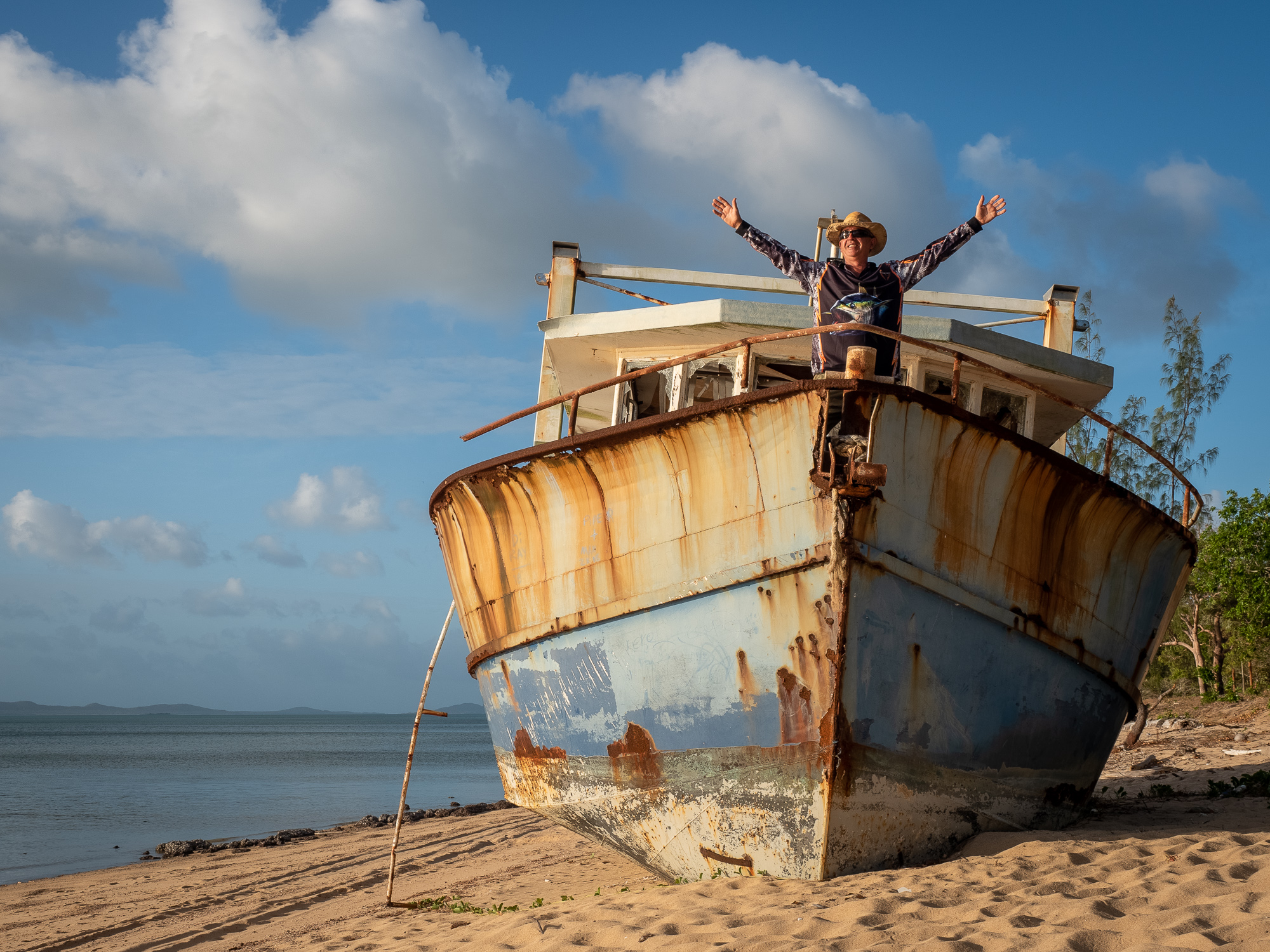
<< Photo credit: Tony – Rod doing his “I’m the king of the world”, Titanic impression >>
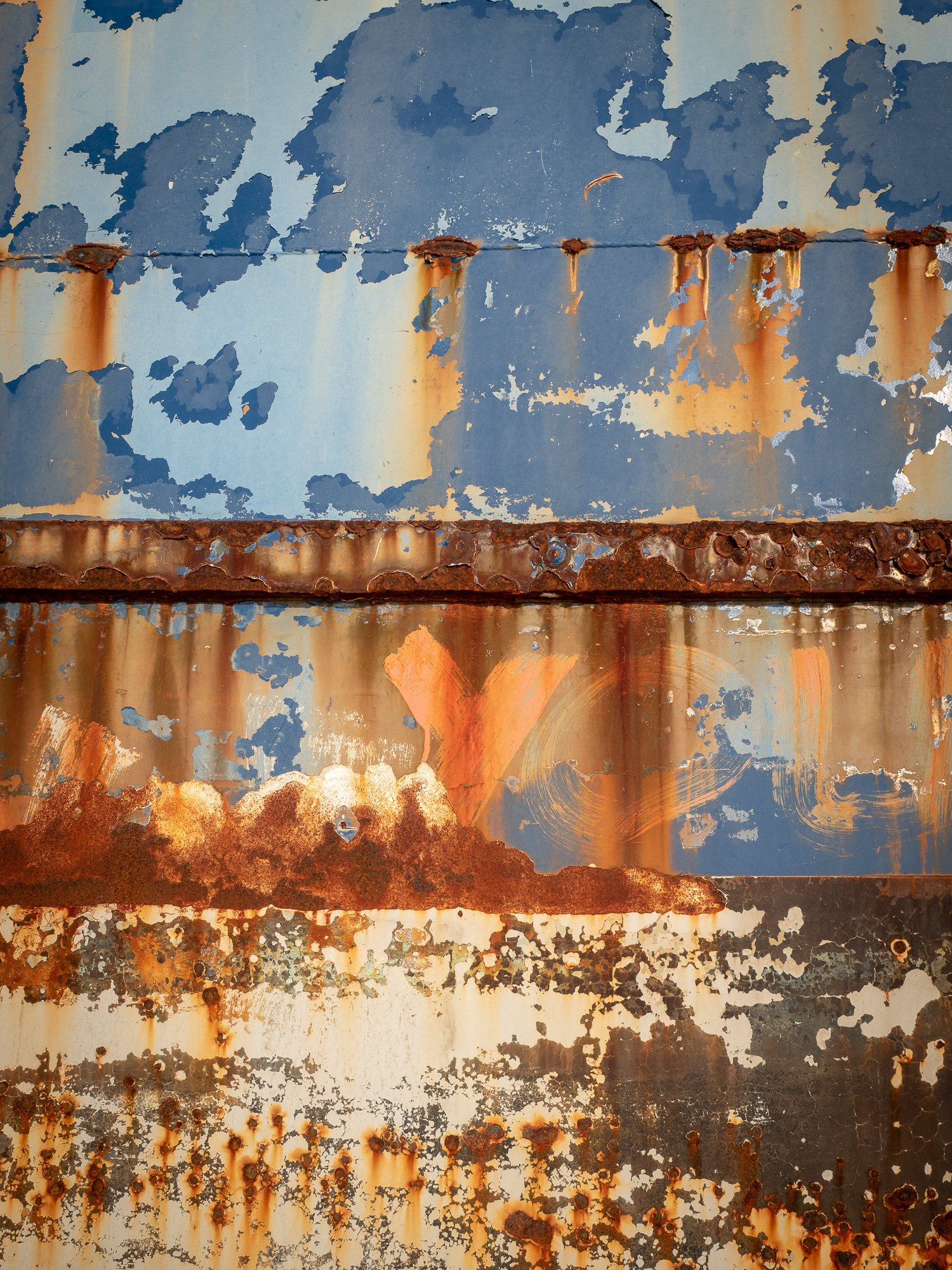
<< Photo credit: Tony – A colour abstract of the old boat >>
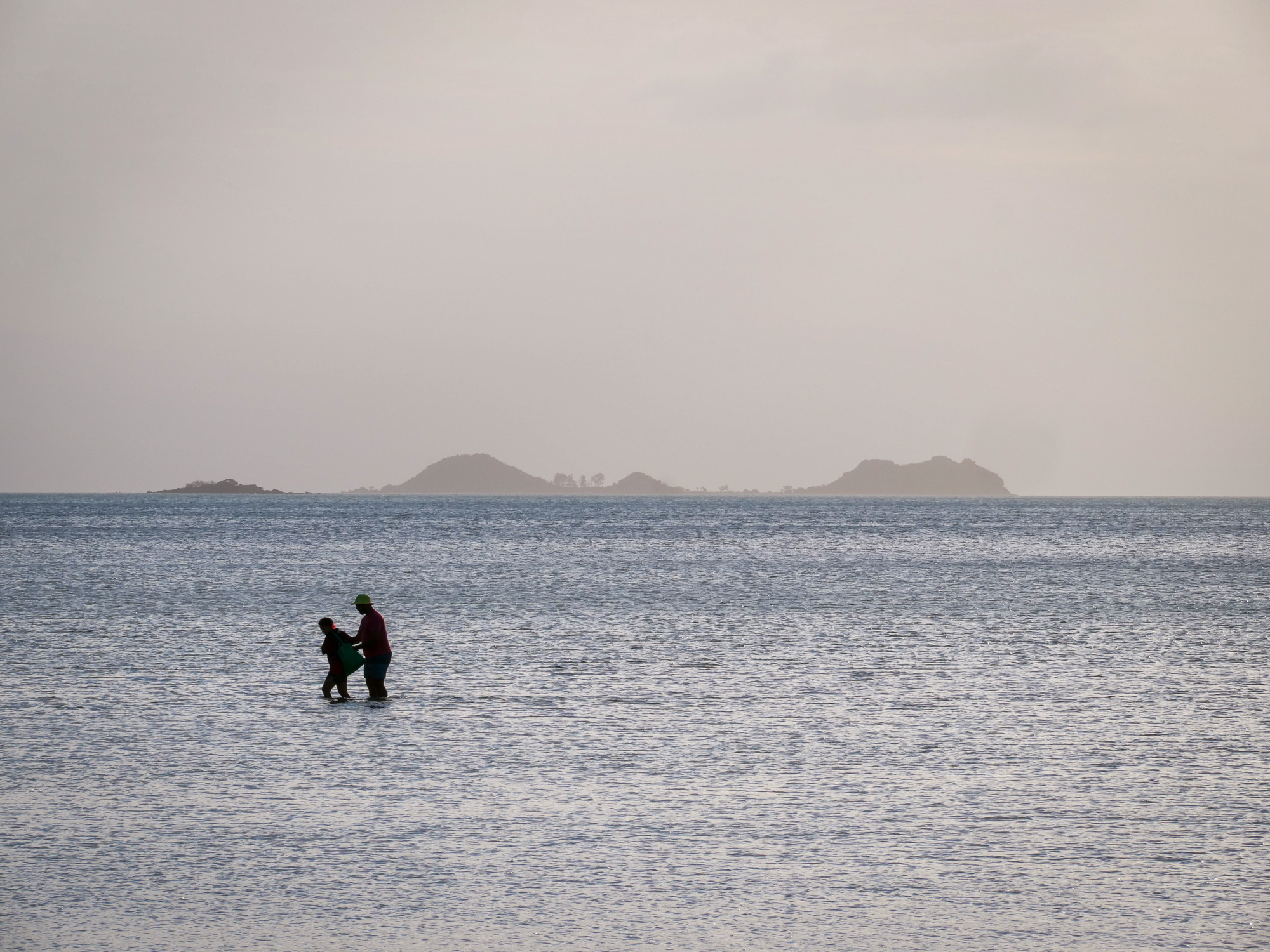
<< Photo credit: Rod – Some local islanders, out getting a feed >>
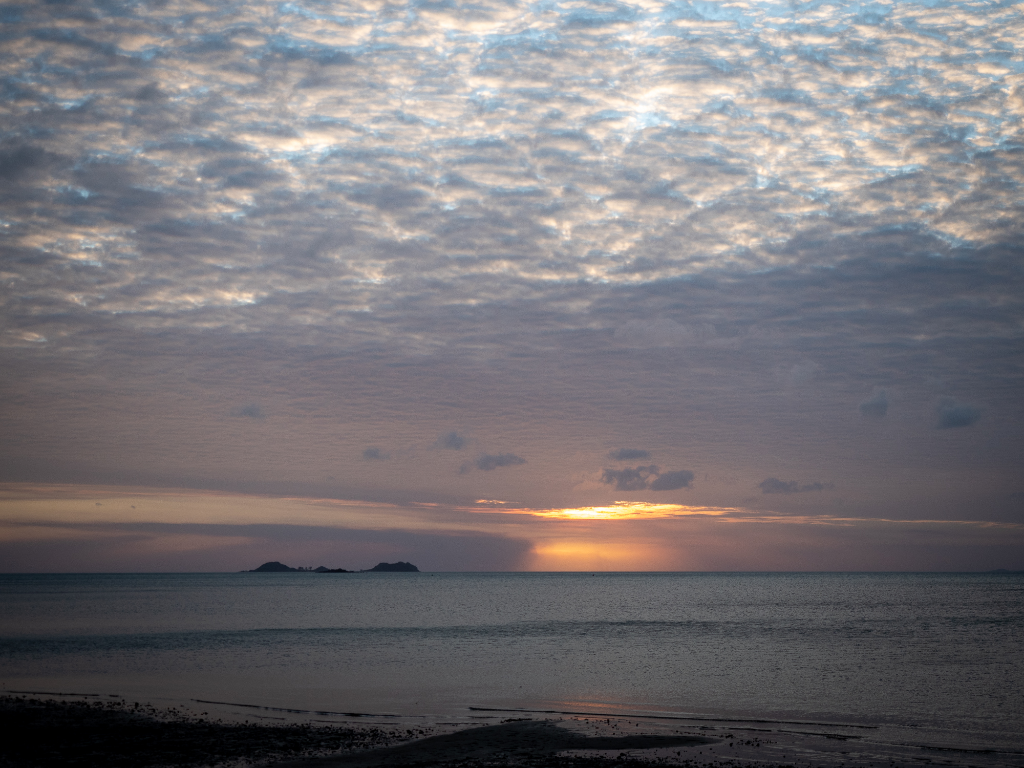
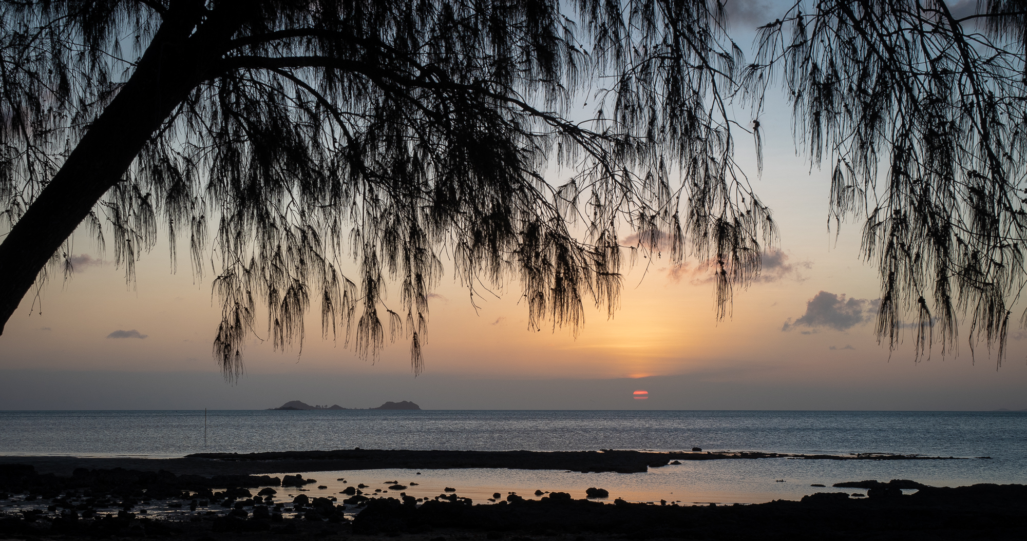
<< Photo credit: Tony – Pic 1 of 4 of the ever changing sunset we had on our last night >>
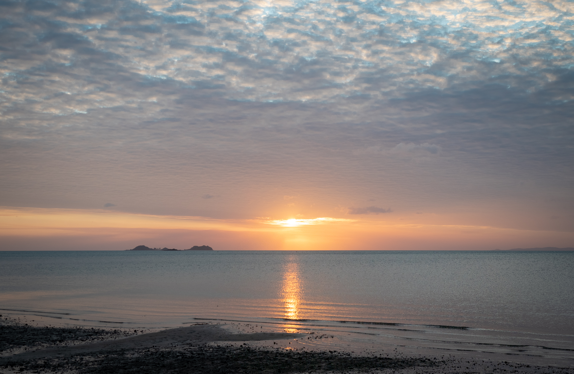
<< Photo credit: Tony – Pic 2 of 4 of the ever changing sunset we had on our last night >>
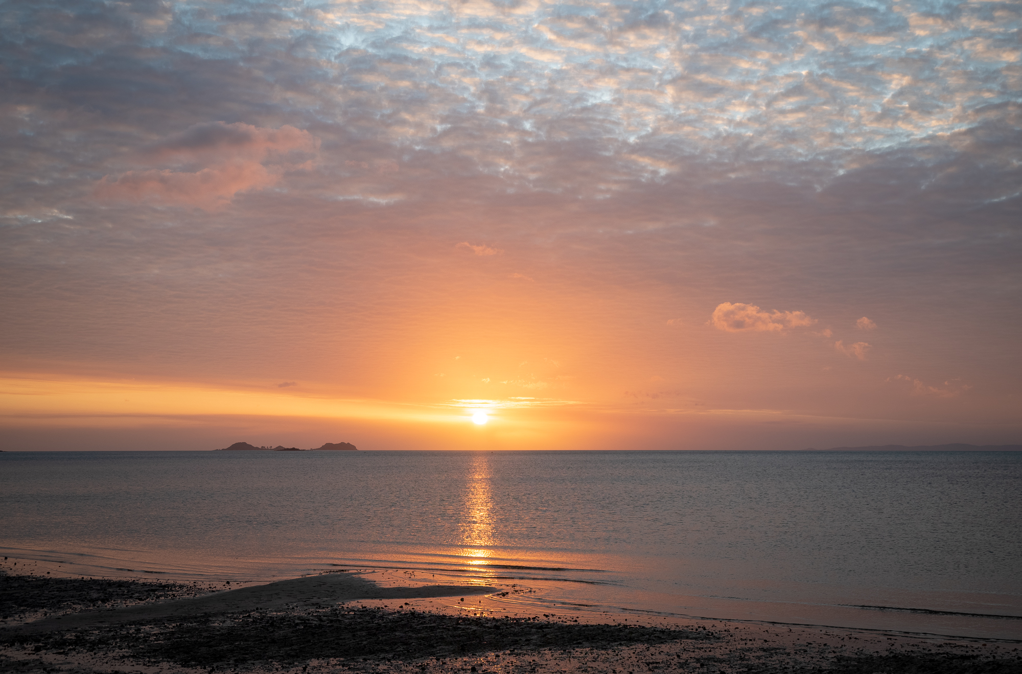
<< Photo credit: Tony – Pic 3 of 4 of the ever changing sunset we had on our last night >>
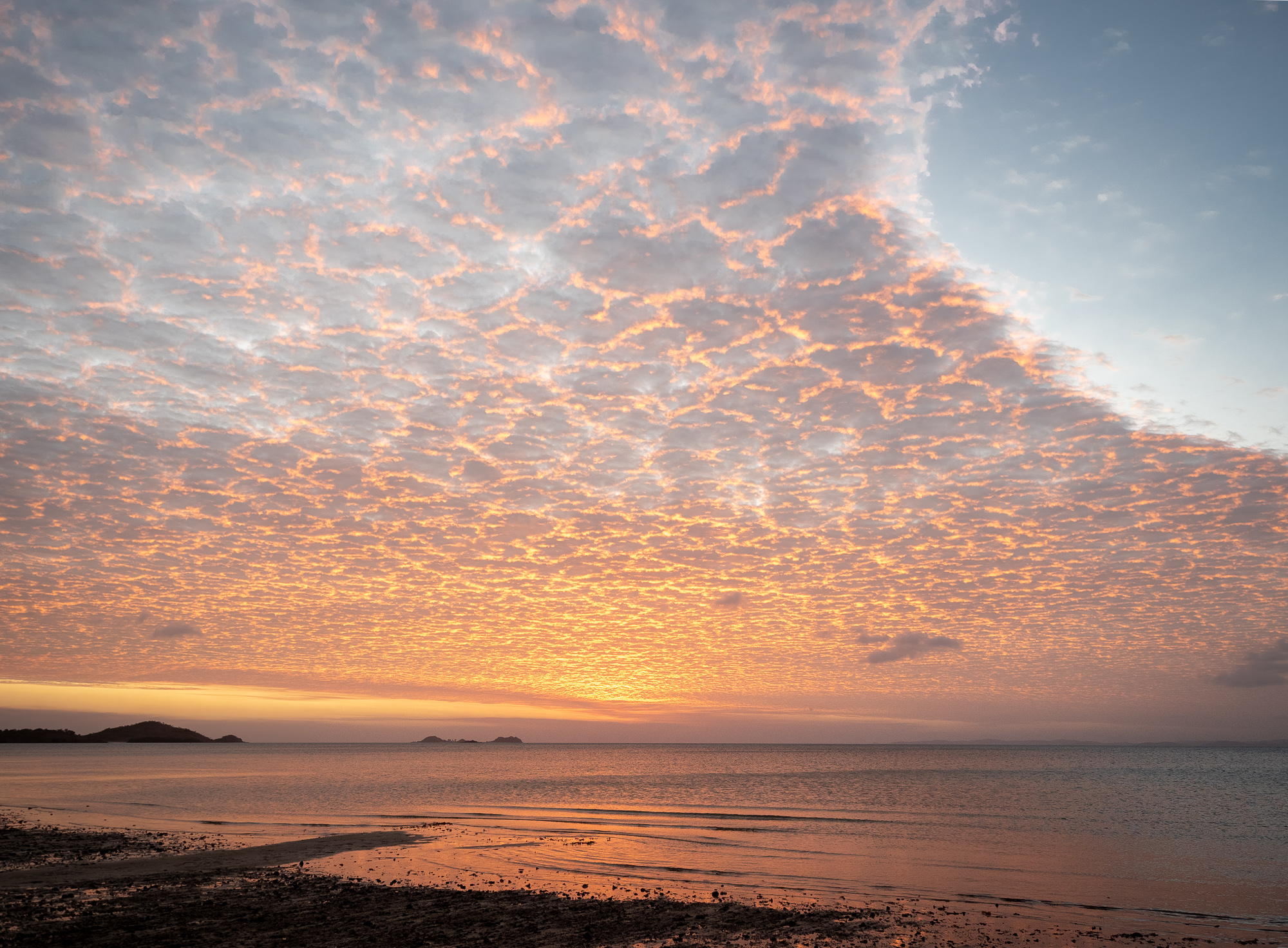
<< Photo credit: Tony – Pic 4 of 4 of the ever changing sunset we had on our last night >>
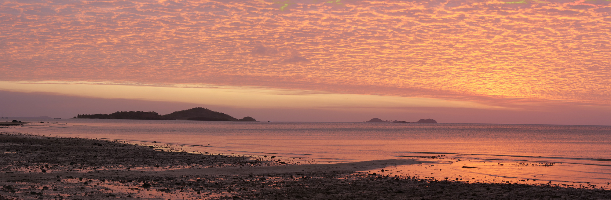
<< Photo credit: Rod – Rod’s pano of the sunset we had on our last night >>
All in all, a great couple of days, with lots of new experiences and memories to treasure. Tomorrow, Thursday 13th, we officially start our slow trek home, heading south, back through Coen, then to Atherton for a couple of days, but more on that in our next blog.
Another great Russell Coight Australian Adventure